

Modern Distance Measurement with ToF, LiDAR, & SLAM Mapping Technology

How Does ToF Technology Measure Distances and Support 3D Mapping and SLAM?
Throughout the development of human civilization, measuring distance and drawing maps have always been core abilities for understanding the world. From the oldest map of the world, to the use of the quadrant instrument for measuring celestial heights, and to today’s mobile mapping systems based on ToF, LiDAR, and SLAM, distance measurement technologies have continuously evolved.
This article, centered on TOF (Time-of-Flight) technology, systematically explores how distance measurement, localization, and map construction have progressed from historical methods to modern systems—and how they now play a critical role in drones, 3D mapping, planetology, and autonomous navigation.
The Earliest Maps and the Concept of Distance: From the World’s Beginning to Zero Latitude and Longitude
Human understanding of space first took shape through maps.
Historians generally agree that the oldest world map / oldest map in the world can be traced back to ancient Babylonian civilization. Although these early maps were not precise, they represented humanity’s first attempts to describe the shape of the world.
Over time, more systematic coordinate systems were established, such as:
-
Latitude 0, longitude 0 (0 lat 0 long)
-
A global coordinate framework centered on the Earth
These concepts later became the foundation of modern GIS, navigation systems, and autonomous driving technologies.

Early Measurement Tools: Quadrants, Levels, and Height Estimation
Before electronic sensors existed, humans relied on physical instruments for distance measurement and positioning:
-
Quadrant instrument / quadrant tool
Used to measure the altitude of celestial bodies and infer latitude -
Water level detection tools (water level detector sensor / level sensor for water)
Used to determine whether surfaces were level, playing a crucial role in early engineering and cartography
Although these early generic mapping tools had limited accuracy, they established the fundamental logic of measurement → localization → mapping, which remains valid today.
From Static Maps to Mobile Mapping
Traditional maps are static results, but the modern world requires dynamic perception.
This need gave rise to mobile mapping.
Modern mobile mapping systems typically integrate:
-
Cameras
-
IMUs
-
GNSS
-
ToF / LiDAR sensors
These systems collect environmental data in real time while moving, enabling applications such as:
-
Urban 3D modeling
-
Road and infrastructure inspection
-
Autonomous driving
-
Digitalization of physical assets

What Is Time-of-Flight (ToF)?
Time-of-Flight (ToF) is a technology used for distance measurement and 3D depth perception. Its core principle is simple:
distance is calculated by measuring the time it takes for light to travel from the emitter to an object and back to the sensor.
In practice, a ToF system emits modulated infrared light or laser pulses. When the light reflects off an object and returns, the sensor calculates the distance using the measured flight time and the known speed of light, generating depth information or a depth map.
Key advantages of ToF technology include:
-
High real-time performance: Depth data can be obtained within milliseconds, making it suitable for dynamic scenes
-
High measurement accuracy: Achieves centimeter-level or even higher precision
-
Strong resistance to ambient light: Works reliably in both indoor and outdoor lighting conditions
-
High computational efficiency: Short processing pipelines and low system latency
As a result, ToF is widely used in RGB-D cameras, robot navigation and obstacle avoidance, SLAM mapping, autonomous driving perception, industrial measurement, AR/VR spatial sensing, and face and gesture recognition, making it a core technology in modern 3D vision and depth perception systems.
ToF Technology: The Core Engine of Modern Distance Measurement
Time-of-Flight (ToF) technology is an active distance measurement method based on the physical principle of light speed. By measuring the time it takes for light to travel from emission to reflection and back, ToF accurately calculates the distance between a sensor and a target.
Because the speed of light is constant, ToF can directly convert time differences into high-precision distance data, making it one of the foundational technologies for modern 3D measurement, spatial perception, and digital modeling systems.
In real-world applications, ToF is widely embedded in RGB-D cameras, LiDAR systems, mobile mapping platforms, UAV LiDAR mapping, and SLAM-based navigation systems, serving as a critical bridge between the physical world and digital space.
Core Advantages of ToF Technology
1. High-Precision Distance Measurement: From Centimeter to Millimeter-Level Spatial Quantification
With time resolutions at the nanosecond or even picosecond level, ToF technology can achieve distance measurement accuracy ranging from millimeters to meters, far exceeding traditional estimation methods, visual scaling, or historical experience-based measurements.
In large-scale environments such as roads, terrain, industrial sites, and ports, ToF can reliably measure distances of tens or even hundreds of meters. In short-range applications—such as industrial inspection, robotic grasping, and 3D scanning—it delivers fine-grained surface depth details. This high precision makes ToF indispensable in modern engineering measurement, scientific research, and automation systems.
2. Strong Real-Time Performance: Enabling Continuous Measurement and Mapping in Dynamic Environments
Unlike traditional static measurement tools, ToF sensors provide millisecond-level or faster real-time updates, continuously outputting stable distance data even while the device or environment is in motion.
This capability is particularly critical for:
-
Mobile mapping
-
UAV aerial surveying and inspection
-
Autonomous driving and robotic navigation
-
Real-time SLAM mapping and localization
In these scenarios, systems no longer rely on “measure first, process later.” Instead, they can measure, map, and update simultaneously while moving, greatly improving efficiency and safety.
3. Strong Environmental Adaptability: Suitable for Complex Lighting and Outdoor Scenarios
ToF is an active sensing technology that relies on emitted infrared light or laser signals rather than ambient illumination. Compared with passive vision systems such as standard RGB cameras, ToF is far less sensitive to lighting changes.
In practice, ToF performs reliably under conditions such as:
-
Strong or weak ambient light
-
Complex shadowed areas
-
Nighttime or low-visibility environments
-
Outdoor mapping and long-range detection
This makes ToF highly advantageous in outdoor engineering, UAV mapping, maritime distance measurement, and road inspection, and explains why it forms the core ranging principle of LiDAR systems.
4. Scalable to 3D Depth Perception: From Single-Point Ranging to Full Spatial Modeling
ToF is not limited to measuring a single distance. Using sensor arrays, it can perform per-pixel distance measurement, generating:
-
Depth maps
-
Point cloud data
-
Full 3D spatial reconstructions
This capability makes ToF a foundational component of 3D vision systems, widely applied in:
-
Urban and terrain 3D modeling
-
Industrial spatial layout analysis
-
Building and infrastructure digitization
-
AR/VR spatial perception
-
Robotic environment understanding and path planning
Through ToF technology, traditional two-dimensional maps are upgraded into true-scale three-dimensional spatial models, providing reliable data foundations for digital twins, intelligent manufacturing, and advanced automation systems.

Why ToF Has Become the Core Technology of Modern Distance Measurement
Taken as a whole, ToF technology tightly integrates physical distance measurement, real-time computation, and 3D spatial modeling, effectively overcoming the limitations of traditional ranging methods in terms of accuracy, efficiency, and performance in dynamic environments.
For this reason, ToF has become the core engine of modern surveying, navigation, SLAM systems, LiDAR platforms, and intelligent perception devices.
LiDAR for UAV: The Key Application of ToF in Aerial Mapping
In the field of drone-based surveying, LiDAR for UAV is essentially a highly integrated and engineered application of Time-of-Flight (ToF) technology on an airborne platform.
By mounting ToF-based LiDAR sensors on unmanned aerial vehicles (UAVs), the system continuously emits laser pulses toward the ground or target areas during flight and precisely measures the round-trip time of the laser signals to obtain high-accuracy spatial distance data.
This ToF-based aerial surveying approach transforms drones from simple 'imaging tools' into true 3D spatial measurement and modeling platforms.
Core Capabilities Enabled by ToF-LiDAR UAVs
1. Large-Scale Terrain Scanning and 3D Modeling
ToF-LiDAR UAVs can cover large areas in a short time, enabling continuous and high-density terrain scanning.
By converting each ToF distance measurement into 3D point cloud data, the system can rapidly generate:
-
Digital Elevation Models (DEM)
-
Digital Surface Models (DSM)
-
3D terrain and urban models
As a result, ToF-LiDAR UAVs are widely used in geospatial surveying, urban planning, road and railway design, and land resource surveys, delivering efficiency far beyond that of traditional manual measurement methods.
2. Forest Height and Vegetation Structure Analysis
In forestry and ecological monitoring, traditional aerial imagery relies heavily on surface textures and struggles to penetrate forest canopies.
In contrast, ToF-based LiDAR for UAV systems can leverage multi-return measurements to distinguish:
-
Canopy height
-
Understory terrain
-
Vertical vegetation structure
This enables accurate forest height analysis, biomass estimation, and carbon stock assessment, which is why ToF-LiDAR has become a core technology in modern forestry mapping and environmental science.
3. Mining, Construction Sites, and Engineering Surveying
In complex environments such as mines, open-pit quarries, and construction sites—where terrain changes rapidly and manual measurements carry high risk—ToF-LiDAR UAVs can perform regular or on-demand aerial scans to achieve:
-
Earthwork volume calculations
-
Mining and construction progress monitoring
-
Deformation analysis
-
Safety distance and boundary measurements
Thanks to the high accuracy and stability of ToF ranging, engineering survey results offer superior repeatability and verifiability, meeting the requirements of modern engineering management and digital construction workflows.
4. Flood, Steam, and Gas Uplift Analysis (Lift Vapor Scenarios)
In emergency response and environmental monitoring, the advantages of ToF-LiDAR become particularly evident.
In scenarios involving flooding, steam, smoke, or gas uplift (lift vapor), conventional visible-light aerial imaging often fails due to low contrast or missing texture.
By relying on active laser ranging, ToF-LiDAR can partially penetrate or reliably detect such dynamic media, enabling:
-
Flood water level monitoring
-
Industrial steam dispersion analysis
-
Fire smoke plume height and extent assessment
-
Spatial distribution analysis of gas leaks
These capabilities are highly valuable in emergency rescue, industrial safety, and environmental protection applications.
Key Advantages of ToF-LiDAR Over Traditional UAV Aerial Imaging
Compared with traditional aerial photography that depends on image texture and lighting conditions, LiDAR for UAV based on ToF ranging offers clear advantages:
-
Independent of surface texture or color
-
Stable performance in low-visibility, low-light, or complex environments
-
Direct measurement of true spatial distances rather than visual estimation
-
Better suited for complex terrain, dense vegetation, and dynamic scenes
As a result, within modern surveying systems, ToF-LiDAR UAVs have evolved from an auxiliary tool into a primary solution for high-precision aerial measurement.
What Is SLAM? The Critical Role of ToF in 'Mapping While Moving'
Many people search for 'what is SLAM', but the core question is actually:
How can a device localize itself while simultaneously building a map in an unknown environment?
SLAM (Simultaneous Localization and Mapping) is the answer.
Within SLAM systems:
-
ToF provides precise distance measurements
-
Depth data supports obstacle detection
-
Point clouds enable spatial structure modeling
This allows robots, autonomous vehicles, and AR devices to localize accurately even in GPS-denied environments.
From Earth to Other Planets: ToF and Planetology
In planetology, ToF-based ranging technologies are equally essential.
Whether it is:
-
Lunar terrain scanning
-
Mars rover navigation
-
Asteroid surface modeling
ToF-LiDAR acts as the 'eye of spatial perception,' converting distant celestial bodies into measurable, quantifiable spatial models.
Mapping Is Not Only Technology, but Also Culture and History
Mapping and measurement are not purely engineering challenges—they also carry cultural and historical significance.
Examples include:
-
The New Mexico state motto: Crescit Eundo ('It grows as it goes')
-
The New Mexico Territory and early cartography
-
National and regional symbols such as the State of New Mexico Seal
These historical elements remind us that human exploration of space has always evolved alongside technological progress.
Conclusion: From the Quadrant Instrument to ToF—Distance Measurement Continues to “Grow as It Goes”
From the earliest world maps, to latitude and longitude systems, and to today’s:
-
ToF depth sensors
-
UAV LiDAR systems
-
SLAM frameworks
-
Mobile mapping platforms
distance measurement technologies continue to evolve.
As expressed by crescit eundo—
technology grows by moving forward, and ToF represents a major milestone in modern spatial perception.
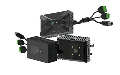
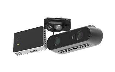
Synexens 3D Camera Of ToF Sensor Soild-State Lidar_CS20

After-sales Support:
Our professional technical team specializing in 3D camera ranging is ready to assist you at any time. Whether you encounter any issues with your TOF camera after purchase or need clarification on TOF technology, feel free to contact us anytime. We are committed to providing high-quality technical after-sales service and user experience, ensuring your peace of mind in both shopping and using our products