

What Is a SLAM Scanner? 3D Mapping, LiDAR & SLAM Camera Explained
- Posted by TofSensor
How Do SLAM Scanners Work and How Are They Used for 3D Mapping and Autonomous Navigation?
With the rapid development of intelligent robotics, autonomous driving, and digital twin technologies, the SLAM scanner has become one of the core technologies for environmental perception and autonomous positioning. It enables devices to build maps while moving in unknown environments and simultaneously localize themselves, a capability known as SLAM (Simultaneous Localization and Mapping).
In recent years, with the development of slam camera, slam lidar sensor, and 3d slam mapping, SLAM scanning systems have moved from research labs to industrial applications, widely used in robotics navigation, warehouse automation, autonomous driving, and 3D surveying.
1. What Is a SLAM Scanner?
A SLAM scanner is a high-precision 3D environmental perception device based on the SLAM (Simultaneous Localization and Mapping) algorithm. It can collect environmental data in real time while moving in unknown or dynamic environments and simultaneously perform localization and mapping. It is also known as a 'mobile 3D mapping system' or 'real-time spatial scanning device.'
Unlike traditional surveying tools, a SLAM scanner does not rely on GPS or external positioning systems. Instead, it uses multi-sensor fusion and algorithmic computation to build spatial awareness in complex environments. This makes it a key technology for robotics, autonomous driving, drones, and digital twin systems.
Core Capabilities of a SLAM Scanner
A complete SLAM scanning system typically includes the following capabilities:
- Real-time localization: continuously calculating precise position during movement
- Mapping: dynamically generating 2D or 3D SLAM maps
- Dynamic path updating: adjusting motion paths based on environmental changes
- 3D reconstruction: building high-precision point cloud models of real-world environments
Together, these form the foundation of 3D SLAM (Simultaneous Localization and Mapping), enabling autonomous operation in unknown environments.

Core Components of SLAM Systems
A typical SLAM scanner system is not a single device but a multi-sensor and algorithmic architecture:
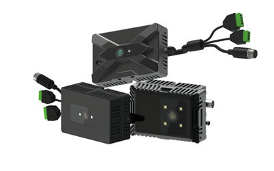
- SLAM camera (visual SLAM camera): captures visual features for environment understanding and semantic tasks
- SLAM LiDAR sensor: provides high-precision distance measurement and point cloud data, essential for industrial SLAM
- IMU (Inertial Measurement Unit): measures acceleration and angular velocity to improve motion estimation stability
- SLAM algorithm module: performs data fusion, pose estimation, and map optimization (Graph Optimization)
Through multi-sensor collaboration, the system achieves higher accuracy and more complete environmental modeling.
How SLAM Scanners Work Without GPS
One of the most important capabilities of a SLAM scanner is operating without GPS. It achieves this through:
- Capturing environmental features using a SLAM camera or SLAM LiDAR sensor
- Extracting and matching feature points
- Combining IMU data for motion compensation
- Real-time pose estimation
- Continuous loop closure optimization
This allows SLAM scanners to operate reliably in underground spaces, indoor factories, warehouses, tunnels, and complex urban environments.
3D SLAM Mapping Capability
One of the most important outputs of a SLAM scanner is 3D SLAM mapping.
It can generate:
- High-precision 3D point cloud models
- Visual mesh maps
- Real-time updated dynamic maps
These outputs are widely used in:
- Factory digital twin modeling
- Building surveying and BIM modeling
- Robot path planning
- Autonomous driving HD map construction
2. Principles of 3D SLAM
3D SLAM is an advanced version of SLAM that constructs not only 2D maps but also full 3D spatial models.
Its core process includes:
- Sensor data acquisition (camera / LiDAR)
- Feature extraction
- Pose estimation
- Graph optimization
- 3D point cloud generation
During this process, continuous SLAM scanning is performed to build a complete environmental structure.
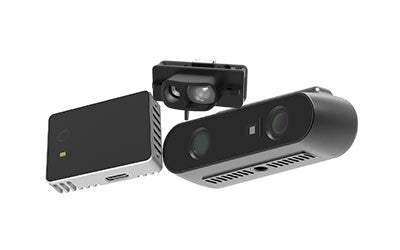
3. Role of SLAM Cameras
A SLAM camera is a key component of visual SLAM systems, using image or depth information to understand the environment.
Types include:
- RGB camera SLAM
- RGB-D depth cameras
- Stereo vision SLAM systems
Advantages:
- Lower cost
- Suitable for indoor environments
- Capable of semantic recognition
However, performance may degrade in low-light or textureless environments, so it is often combined with LiDAR systems.
4. SLAM LiDAR Sensors
A SLAM LiDAR sensor is one of the most stable solutions in industrial SLAM systems.
It works by scanning the environment with lasers and measuring distances to generate high-precision point cloud data.
Advantages:
- High accuracy (centimeter or even millimeter level)
- Not affected by lighting conditions
- Suitable for large outdoor environments
Typical applications:
- Autonomous vehicles
- Industrial robot navigation
- Unmanned inspection systems
5. SLAM 3D Mapping Technology
SLAM 3D mapping converts environmental data into visual 3D models.
Applications include:
- Factory digital modeling
- Building scanning and surveying
- Indoor navigation maps
- AR/VR spatial reconstruction
Through continuous scanning and optimization, systems generate high-precision 3D SLAM maps.
6. SLAM Scan LiDAR and SLAM Scanning
In practical applications, SLAM scan LiDAR is a key device for high-precision scanning.
Features include:
- High-speed environmental scanning
- Real-time point cloud generation
- Support for dynamic environment modeling
SLAM scanning refers to the continuous process of collecting environmental data and updating maps, which is the core operation of SLAM systems.

7. MAVE 3D SLAM and Mobile Scanning Systems
Recently, MAVE 3D SLAM systems have gained popularity. They are typically integrated into portable scanning devices or mobile robots.
Features:
- Handheld or mobile scanning
- Fast environment mapping
- Flexible deployment
- Suitable for indoor and outdoor hybrid environments
Applications include:
- Building scanning
- Digital twin factories
- Complex terrain surveying
8. SLAM Scanners Application Scenarios
Modern SLAM scanners have evolved into a critical infrastructure for robotics, autonomous driving, and digital twin systems. Thanks to SLAM scanning and 3D SLAM mapping, they enable real-time positioning and high-precision spatial modeling.
1. Robotics Navigation
SLAM scanners enable autonomous movement through:
- Real-time localization
- Path planning
- Obstacle avoidance
- Indoor and outdoor navigation
They allow warehouse robots to operate without GPS, dynamically adjusting routes based on obstacles.
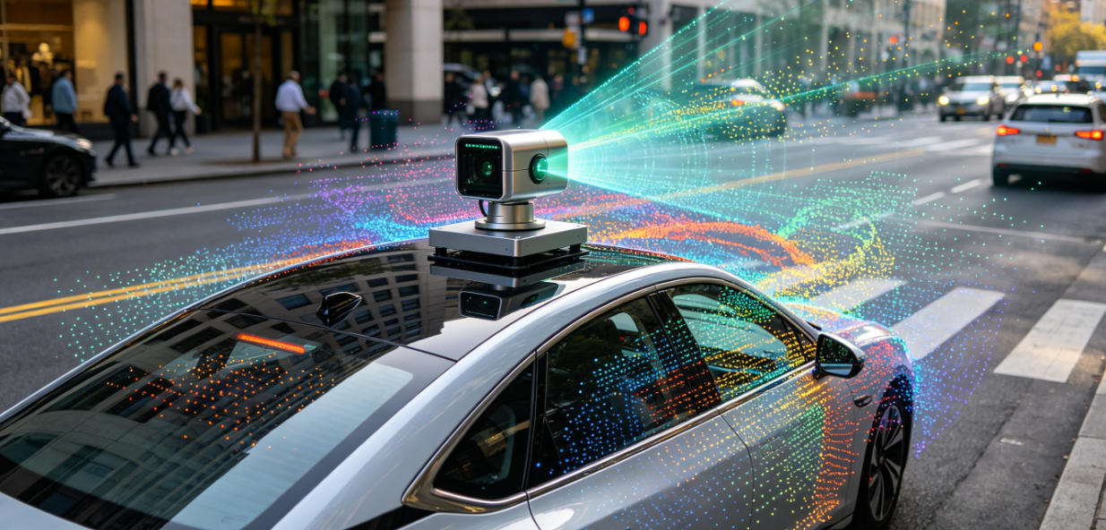
2. Autonomous Driving
SLAM systems help vehicles build real-time environmental models:
- Real-time road mapping
- Vehicle localization
- Object and obstacle detection
- Path prediction in complex traffic
Combined with 3D SLAM mapping, vehicles achieve higher safety and accuracy.
3. Industrial Mapping and Digital Factories
SLAM scanners enable fast 3D modeling of industrial environments:
- Factory digital twin creation
- Warehouse optimization
- Asset digitization
- Production line analysis
They significantly reduce cost and time compared to traditional surveying.
4. Construction and Smart City Mapping
SLAM scanners generate high-precision city and building models for:
- BIM modeling
- Construction monitoring
- Infrastructure mapping
- Historical building preservation
9. SLAM Technology Trends
SLAM is evolving toward:
- AI-enhanced SLAM
- Multi-sensor fusion (Camera + LiDAR + IMU)
- Real-time 3D mapping
- Edge computing SLAM
- Lightweight mobile scanning systems
10. Conclusion
The SLAM scanner is a core technology in modern intelligent systems, combining SLAM camera, SLAM LiDAR sensor, and 3D SLAM mapping to achieve a leap from 2D positioning to 3D spatial reconstruction.
With the continuous development of 3D SLAM, SLAM scanning, and MAVE 3D SLAM, SLAM systems are becoming an essential foundation for robotics, autonomous driving, and digital twin industries.
In the future, SLAM will further integrate AI to achieve more accurate, real-time, and intelligent spatial perception and decision-making capabilities.
Synexens 3D Camera Of ToF Sensor Soild-State Lidar_CS20

After-sales Support:
Our professional technical team specializing in 3D camera ranging is ready to assist you at any time. Whether you encounter any issues with your TOF camera after purchase or need clarification on TOF technology, feel free to contact us anytime. We are committed to providing high-quality technical after-sales service and user experience, ensuring your peace of mind in both shopping and using our products