

The Role of TOF Technology in Drone LiDAR Mapping and FOV Optimization
What is Field of View (FOV)?
Field of View (FOV) refers to the range that optical or imaging systems can capture. It determines the visible area of a sensor or camera and is widely used in optical imaging, environmental sensors, drone mapping, and LiDAR (Light Detection and Ranging) technologies. In LiDAR UAV applications, the size of the FOV directly affects mapping accuracy, coverage area, and scanning efficiency. A larger FOV can capture broader terrain information, improving mapping efficiency, but may reduce resolution; while a smaller FOV helps in obtaining finer details. Therefore, adjusting the FOV parameter is essential for different mapping tasks.
What is TOF (Time of Flight) Technology?
TOF (Time of Flight) technology is a distance measurement method that calculates the distance of an object by emitting a light pulse and measuring the time it takes to return. TOF sensors are widely used in autonomous driving, robotics, 3D imaging, industrial inspection, and drone mapping applications. In drone LiDAR systems, TOF technology enables high-precision depth measurements, improving terrain modeling and environmental monitoring accuracy.

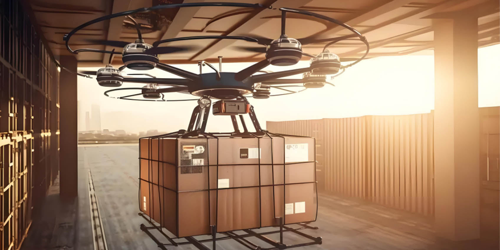
The Integration of TOF and LiDAR in Drones (LiDAR UAV)
The integration of TOF technology and LiDAR sensors can significantly enhance a drone's capabilities in mapping and environmental monitoring. A LiDAR drone uses TOF technology to capture terrain data while adjusting the FOV to optimize scanning range, making mapping more efficient and accurate. TOF sensors enable quick measurement of ground elevations and produce high-resolution terrain maps, crucial for urban planning, agriculture, forestry monitoring, and other industries.
Advantages of LiDAR Drones
Compared to traditional mapping methods, LiDAR drones offer higher precision and better environmental adaptability. LiDAR sensors can penetrate vegetation to capture true ground surface data, providing reliable mapping even in complex terrains or harsh weather conditions. When equipped with LiDAR, drones can collect data over large areas much faster than manual surveying, reducing costs and risks.
The Role of TOF in Drone LiDAR Mapping
-
Improving Mapping Precision
TOF sensors use light pulse distance measurement technology to provide millimeter-level depth data, allowing drones to achieve high-precision mapping even in complex terrain or harsh environments. Unlike traditional optical measurement methods, TOF technology is unaffected by lighting conditions, allowing accurate measurement of ground contours, building heights, and other critical information, even in strong light, shadow, or low-visibility environments. This makes LiDAR UAVs excel in high-precision mapping, terrain reconstruction, and underground pipeline detection applications. -
Optimizing FOV Management
By adjusting the FOV (Field of View), LiDAR drones can meet various mapping needs. For instance, when mapping large areas, a wider FOV can improve data collection efficiency, reduce the number of flights, and increase coverage; while in fine mapping tasks, narrowing the FOV enhances local scanning accuracy, ensuring detailed integrity. Additionally, TOF technology can dynamically adjust FOV parameters to adapt to different environments, such as urban areas with dense buildings, forested areas, or complex industrial parks, allowing the drone to achieve optimal mapping performance in various scenarios. -
Enhancing 3D Modeling Capabilities
The combination of TOF technology and LiDAR enables high-precision 3D modeling, widely used in urban planning, mineral exploration, and building monitoring. LiDAR UAVs capture ground structural information with TOF sensors, generating high-resolution 3D point cloud data that provides accurate spatial data for smart city development, bridge and tunnel monitoring, and archaeological research. Moreover, TOF technology can detect material properties and surface features, further improving the realism and detail of 3D models, offering a more accurate data foundation for intelligent surveying and engineering measurements. -
Improving Environmental Adaptability
Traditional mapping technologies can be significantly affected by poor weather or low-visibility conditions (such as fog, night, or dense vegetation). However, drones using TOF technology can operate stably in complex environments, unaffected by natural light changes, making nighttime mapping possible. Additionally, TOF sensors can penetrate fog, smoke, and other interferences, ensuring stable data collection, even in extreme environments (such as deserts, plateaus, and polar regions), continuing to provide high-precision mapping data. This advantage opens up broader application prospects for LiDAR UAVs in disaster relief, field exploration, and ecological monitoring.

Application Areas of LiDAR Drones
-
Terrain Mapping
Using TOF distance measurement technology, LiDAR drones can efficiently complete large-area terrain scans. By accurately emitting and receiving light pulses, TOF sensors provide millimeter-level depth data to generate high-precision digital elevation models (DEMs). These models can be used for detailed terrain analysis, civil engineering projects, urban planning, and more, ensuring the accuracy and comprehensiveness of mapping results over large areas. In complex terrains, mountains, and rugged regions, LiDAR UAVs can replace manual surveying, providing faster and more precise data collection. -
Building and Infrastructure Inspection
LiDAR UAVs can quickly and comprehensively capture building and infrastructure structural information, particularly for large-scale structures like bridges, tunnels, and power towers. Using TOF technology, drones can scan the facades of buildings and detect small surface cracks, providing accurate diagnostic data for engineers to conduct safety assessments and maintenance planning. Furthermore, LiDAR UAVs can perform inspections in high-altitude or hard-to-reach areas (e.g., building rooftops, bridge undersides), ensuring work safety and improving inspection efficiency. -
Agriculture and Forestry Monitoring
With the combination of TOF and LiDAR technology, drones can accurately measure crop height, density, and health status while also assessing forest coverage and vegetation growth. This is crucial for precision agriculture management and forestry resource monitoring. By collecting real-time data, farmers and forestry managers can analyze crop growth, perform precision irrigation, fertilization, pest control, and improve crop yield and quality. Additionally, these data help in forest ecological monitoring, assessing vegetation changes, and their environmental impacts, supporting sustainable development. -
Disaster Monitoring
After natural disasters such as floods, earthquakes, and landslides, LiDAR UAVs can quickly generate 3D maps of disaster areas, accurately recording post-disaster conditions and providing crucial data for rescue decisions. By acquiring high-precision data from disaster-stricken regions in real-time, rescue teams can assess damage to roads, buildings, and transportation infrastructure, plan emergency rescue routes, and improve response efficiency. Moreover, LiDAR technology can help assess soil movement and landslide risk areas, providing scientific guidance for post-disaster recovery efforts. -
Autonomous Driving and Navigation
The integration of LiDAR sensors with TOF technology extends beyond drones and can be widely used in autonomous driving and navigation systems. Autonomous vehicles using the combination of LiDAR and TOF technology can perceive the surrounding environment in real-time, create 3D maps, and achieve smart obstacle avoidance and dynamic route planning. LiDAR sensors rapidly measure the distance to surrounding objects, helping vehicles avoid collisions with obstacles, thereby enhancing driving safety and intelligence. For drones, this technology also assists in precise positioning in complex environments, improving flight stability and navigation accuracy, especially in urban areas, where LiDAR UAVs can avoid collisions with buildings, trees, and other obstacles.
Conclusion
The integration of TOF technology and LiDAR drones offers more efficient and precise solutions for mapping, environmental monitoring, and autonomous driving applications. With the continuous development of drone and LiDAR technologies, TOF sensors will play an increasingly important role, further advancing intelligent mapping and environmental sensing technologies.
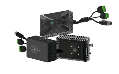
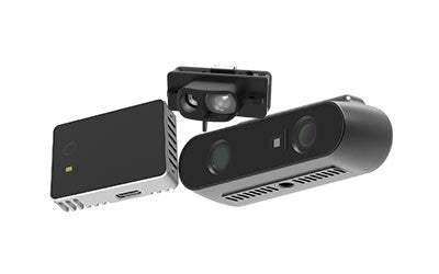
Synexens 3D Of RGBD ToF Depth Sensor_CS30

Our professional technical team specializing in 3D camera ranging is ready to assist you at any time. Whether you encounter any issues with your TOF camera after purchase or need clarification on TOF technology, feel free to contact us anytime. We are committed to providing high-quality technical after-sales service and user experience, ensuring your peace of mind in both shopping and using our products.
-
で掲示されます
CS30