

Master Machine Vision Coordinate Systems & Camera Parameters for 3D

How can coordinate systems and camera parameters enable high-precision 3D measurement in machine vision and robotics?
In modern machine vision systems, the definition of camera parameters and coordinate systems is critical for precise measurement, 3D visual reconstruction, robot navigation, and industrial inspection. Understanding the mapping relationships between different coordinate systems—such as the image space coordinate system, camera matrix intrinsic, and world matrix computer vision definition—is fundamental for camera calibration, 3D point cloud construction, and coordinate transformation.
Common Machine Vision Coordinate Systems
Accurate establishment of coordinate systems is the foundation of image processing, 3D reconstruction, robot navigation, and industrial inspection. Machine vision typically uses four main coordinate systems, each playing a critical role in different applications:
1. World Coordinate System
The world coordinate system serves as a global reference frame to define the 3D positions of objects in the scene. Its origin can be customized based on the application, for example at the robot base, the camera optical center, or the reference point of an AGV (Automated Guided Vehicle). The world coordinate system is essential in multi-camera systems, robotic vision navigation, and 3D reconstruction. It forms the core of the world matrix computer vision definition, allowing data from different sensors to be unified in a global reference frame for multi-view data fusion, precise positioning, and consistent spatial measurement.
2. Camera Coordinate System
The camera coordinate system is established at the camera optical center. The Z-axis typically aligns with the camera’s optical axis, while X and Y axes define the horizontal and vertical directions of the image plane. The camera coordinate system transforms real-world 3D points into the camera's perspective, providing the basis for 2D image projection, depth measurement, and stereo vision processing. In depth cameras, ToF sensors, or stereo vision systems, this coordinate system is key for point cloud generation, 3D reconstruction, and robotic grasp path planning.
3. Image Coordinate System
The image coordinate system is a 2D coordinate system on the camera imaging plane, usually represented as (x, y). Its origin is often at the center of the image plane, measured in millimeters or microns. This system maps 3D points to the 2D image plane and is the practical implementation of the image space coordinate system. It is widely used in computer vision algorithms for object recognition, image processing, feature matching, and 3D reconstruction. Combined with the camera matrix intrinsic, it enables precise mapping from 3D coordinates to pixel coordinates for high-accuracy measurement and control.
4. Pixel Coordinate System
The pixel coordinate system is a 2D coordinate system on the image sensor, measured in pixels. Its origin is typically at the top-left corner of the image, represented as (u, v). This system maps image coordinates to actual sensor output. Through scaling, offset correction, and pixel calibration, the mapping between the image coordinate system and pixel coordinate system is established. In industrial inspection, robotic vision navigation, 3D human counting, and smart warehousing, this mapping ensures high-precision depth measurement, point cloud generation, and reliable image analysis.
How can camera calibration improve depth measurement and point cloud reconstruction?
By solving for camera matrix intrinsic and extrinsic parameters (rotation matrix R and translation vector t), and combining with the image space coordinate system and world matrix computer vision definition, 3D points in the real world can be accurately mapped to images or depth data, improving 3D reconstruction and measurement accuracy.

Camera Intrinsic and Extrinsic Parameters: Understanding Camera Matrix and Coordinate Transformations
In camera calibration and vision geometry, intrinsic parameters and extrinsic parameters are two core parameter groups.
Camera Intrinsic Parameters
Intrinsic parameters describe the camera’s geometric properties, including focal length, principal point coordinates (optical center), and pixel shape. They are represented by the camera matrix intrinsic, which projects 3D points from the camera coordinate system to the image coordinate system.
The intrinsic matrix K is typically expressed as:
where fx, fy are focal lengths along the x and y axes, cx, cy are the coordinates of the principal point, and s is the pixel skew factor.
Camera Extrinsic Parameters
Extrinsic parameters define the camera’s position and orientation relative to the world coordinate system. They consist of a 3×3 rotation matrix R and a 3×1 translation vector t, performing the rigid transformation between world and camera coordinates.
In summary, the complete mapping from 3D world points to 2D pixels involves:
-
World Coordinates → Camera Coordinates
-
Camera Coordinates → Image Coordinates
-
Image Coordinates → Pixel Coordinates
The combination of these transformation matrices forms the complete camera projection matrix, essential for depth reconstruction, object localization, and tracking.

Understanding the Role of Image Space Coordinate System and World Matrix in Vision Applications
Application of Image Space Coordinate System
In computer vision algorithms, mapping pixel coordinates captured by the camera to the image space (image space coordinate system) is fundamental. For example, in point cloud construction, visual SLAM, or depth estimation, the image space combined with camera intrinsics enables accurate 3D reconstruction.
World Matrix Computer Vision Definition
The world matrix describes the relationship between objects in the scene and the world coordinate system. In multi-camera fusion, AR/robotic path planning, and 3D reconstruction, it unifies all camera coordinate systems into a single global reference frame, allowing spatial points from different viewpoints to align and be accurately compared.
Practical Applications of Camera Coordinate Systems and Parameters
1. Camera Calibration
Camera calibration is a core step in machine vision systems. By solving for camera matrix intrinsic and extrinsic parameters (rotation matrix R and translation vector t), real-world 3D points can be accurately mapped to 2D pixel coordinates on the image plane. This ensures measurement accuracy and provides foundational data for 3D reconstruction, depth measurement, robot positioning, and industrial inspection. Calibration can also optimize optical distortion, principal point offsets, and pixel scaling using the image space coordinate system, improving multi-camera synchronization, measurement precision, and repeatability.
2. Depth Camera and Point Cloud Reconstruction
In depth cameras, ToF sensors, or RGBD camera systems, using intrinsic and extrinsic parameters to convert 2D depth maps into 3D point cloud data is key to precise spatial perception. Point cloud reconstruction is widely used in industrial automation, smart warehousing, robotic arm grasping, object recognition, and shape measurement. By integrating with the world matrix computer vision definition, point clouds from multiple cameras can be unified in a global coordinate system, enhancing object localization accuracy and operational reliability for robots or inspection systems.
3. Robot Vision Navigation and Path Planning
Robots navigating complex environments rely heavily on a global reference provided by the world matrix. By mapping 3D data from depth cameras, ToF sensors, or stereo vision systems to the world coordinate system, robots can accurately perceive obstacle positions and shapes, enabling tasks such as AGV/AMR navigation, industrial inspection, and intelligent logistics handling. Combined with camera matrix intrinsic and image space coordinate system, vision systems can achieve high-precision localization, multi-sensor fusion, and real-time dynamic path planning, improving navigation stability and operational efficiency.
Conclusion
Understanding image space coordinate system, camera matrix intrinsic, and world matrix computer vision definition is essential for building accurate camera models and achieving efficient 3D reconstruction. In industrial inspection, robot vision, and depth sensing applications, mastering coordinate system transformations and camera parameter matrices significantly enhances the performance and reliability of machine vision systems.
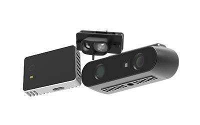
Synexens 3D Camera Of ToF Sensor Soild-State Lidar_CS20

After-sales Support:
Our professional technical team specializing in 3D camera ranging is ready to assist you at any time. Whether you encounter any issues with your TOF camera after purchase or need clarification on TOF technology, feel free to contact us anytime. We are committed to providing high-quality technical after-sales service and user experience, ensuring your peace of mind in both shopping and using our products