

LiDAR and TOF Technology: Applications in Drone Mapping & Smart Cities
In the fields of smart cities, mapping, security, and autonomous driving, LiDAR drones have become indispensable intelligent tools due to their high-precision 3D scanning and rapid data acquisition capabilities. Meanwhile, Time of Flight (TOF) technology, as a core depth-sensing solution, further enhances LiDAR’s range measurement accuracy, environmental adaptability, and real-time dynamic detection ability, enabling LiDAR mapping drones to provide accurate spatial data in various complex scenarios.
What is the Difference Between TOF and LiDAR?
TOF (Time of Flight) and LiDAR (Light Detection and Ranging) are both 3D sensing technologies based on optical distance measurement, but they differ in principles, applications, and accuracy.
1. Principle Differences
- TOF (Time of Flight): Emits a light pulse (usually infrared or laser) and calculates the distance of an object by measuring the time difference between emission and reflection. It is commonly used for 3D imaging and depth measurement. TOF sensors often utilize Single-Photon Avalanche Diodes (SPADs) or CCD/CMOS sensors to detect the reflected light signal.
- LiDAR (Light Detection and Ranging): Uses high-power pulsed laser and determines the distance based on the return time of the laser beam or phase difference. It typically incorporates a scanning system (such as mechanical rotation or MEMS mirrors) to achieve large-scale 3D modeling.
2. Accuracy and Range
- TOF: Typically used for short-range measurements (0.1m-10m), with an accuracy in the millimeter range, making it ideal for applications like smartphone facial recognition, robotic vision, and gesture control.
- LiDAR: Offers a much greater range, reaching hundreds of meters to kilometers, with centimeter-level or even millimeter-level precision, making it more suitable for autonomous driving, mapping, environmental scanning, and drone surveying.
3. Application Scenarios
- TOF: Best suited for short-range 3D sensing, such as smartphone 3D facial recognition (Face ID), AR/VR, industrial robot obstacle avoidance, warehouse management, and automated access control systems.
- LiDAR: Primarily used for large-scale, high-precision 3D modeling, including autonomous driving (environment perception), surveying (terrain modeling), drone navigation, smart city applications (traffic monitoring), and security surveillance.
4. Cost and Power Consumption
- TOF: Uses low-power light sources (such as VCSEL lasers or LEDs), making it cost-effective and energy-efficient, ideal for consumer-grade devices.
- LiDAR: Requires high-power laser emitters and precision detectors, often incorporating a rotational scanning system, leading to higher costs and power consumption, making it more suitable for high-precision industrial applications.
Summary
- TOF is better suited for short-range 3D sensing, commonly used in consumer electronics, industrial automation, and AR/VR applications.
-
LiDAR is designed for large-scale, high-precision 3D mapping, making it the preferred choice for autonomous driving, drone-based surveying, and industrial mapping.
Although both technologies rely on optical distance measurement, TOF excels in low-cost, high-speed applications, while LiDAR offers greater range and accuracy.

The Relationship Between LiDAR and TOF Technology
LiDAR sensors operate using laser-based 3D scanning technology, measuring object distances with high precision by calculating the return time of emitted laser beams. TOF technology serves as a key principle behind LiDAR distance measurement, enabling centimeter-level or even millimeter-level depth accuracy.
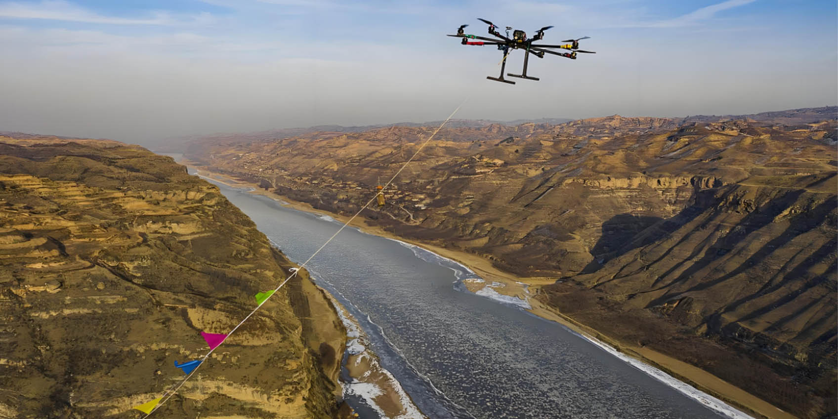
Compared to traditional photogrammetry, drones equipped with LiDAR can penetrate vegetation and building obstructions, accurately capturing topographical and structural details, providing efficient solutions for mapping, agriculture, forestry, and disaster monitoring.

Core Advantages of TOF Technology
TOF sensors, with their high-speed, high-precision, non-contact measurement capabilities, play a crucial role in LiDAR drones, offering the following advantages:
- High-precision distance measurement: TOF technology enables centimeter-level or even millimeter-level depth sensing, enhancing the 3D perception capabilities of LiDAR mapping drones.
- Real-time high-speed sensing: TOF sensors can rapidly capture depth information, allowing drones to detect terrain, obstacles, and environmental changes while flying at high speeds.
- All-weather adaptability: Unlike traditional optical imaging, TOF technology functions reliably in nighttime, strong sunlight, rain, or fog, ensuring LiDAR-equipped drones can operate in diverse conditions.
- Strong environmental resistance: TOF sensors can penetrate smoke, dust, and other obstructions, ensuring accurate data collection even in harsh environments.
- Low power consumption and compact design: TOF technology features small size and low power requirements, making it easier to integrate into LiDAR sensors, improving drone endurance and portability.
- Dynamic target detection: TOF not only measures static objects but also accurately tracks moving targets, providing critical support for autonomous driving and obstacle avoidance systems.
Core Applications of LiDAR Drones
1. High-Precision Mapping and Terrain Modeling
LiDAR mapping drones are widely used in Geographic Information Systems (GIS), terrain surveying, and urban planning. By incorporating LiDAR sensors, drones can quickly capture high-precision terrain data without the need for manual entry into difficult terrain, significantly improving surveying efficiency. TOF technology ensures accurate and stable data collection during flight.
2. Smart City Infrastructure Management
Drones with LiDAR play a crucial role in smart city development, including road inspections, building modeling, and bridge inspections. Combined with TOF technology, LiDAR enables real-time monitoring of infrastructure conditions, detecting road cracks, bridge deformations, and other structural issues to enhance urban maintenance efficiency.
3. Forestry and Agricultural Management
In forestry, LiDAR drones assist in monitoring tree height, canopy density, and disease distribution, providing valuable insights for forest resource management. In agriculture, LiDAR mapping drones analyze terrain, water distribution, and crop conditions, facilitating precision farming strategies. TOF sensors, with their all-weather sensing capabilities, ensure reliable monitoring under varying weather and lighting conditions.
4. Disaster Monitoring and Emergency Response
Following natural disasters such as earthquakes, floods, and landslides, LiDAR-equipped drones can rapidly scan affected areas, generating 3D maps to help rescue teams formulate accurate response plans. TOF technology, with its high-precision distance measurement, ensures reliable data collection even in low-visibility conditions (e.g., smoke, heavy rain).
5. Autonomous Driving and Intelligent Transportation
LiDAR sensors are essential for autonomous vehicles and drone navigation. LiDAR UAVs (Unmanned Aerial Vehicles) can enhance smart traffic management by monitoring road conditions and optimizing traffic flow, supporting autonomous driving with high-precision environmental perception. TOF technology, with its dynamic target detection capability, allows drones to identify pedestrians, vehicles, and obstacles, improving autonomous driving safety and decision-making.
Future Trends of LiDAR and TOF Technology
In the future, as LiDAR drone technology continues to advance, TOF sensors will further enhance distance measurement accuracy and data processing capabilities, enabling drones to play a broader role across various industries. Moreover, with the growing adoption of drones equipped with LiDAR, industries such as autonomous driving, security surveillance, and environmental monitoring will experience a new wave of intelligent upgrades.
As smart cities continue to evolve, LiDAR and TOF technology will undoubtedly serve as key drivers of intelligent transformation, offering more precise, efficient solutions for global smart infrastructure development.
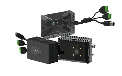
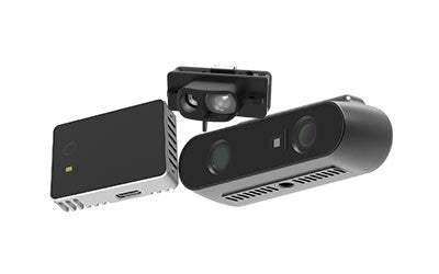
Synexens 3D Of RGBD ToF Depth Sensor_CS30

Our professional technical team specializing in 3D camera ranging is ready to assist you at any time. Whether you encounter any issues with your TOF camera after purchase or need clarification on TOF technology, feel free to contact us anytime. We are committed to providing high-quality technical after-sales service and user experience, ensuring your peace of mind in both shopping and using our products.
-
で掲示されます
CS30