

SLAM Robotique & Markerless Navigation: Core Technology for AMRs
What is SLAM Robotique and How Does It Enable Markerless Robot Navigation?
With the rapid development of industrial automation, smart logistics, intelligent manufacturing, and service robotics, traditional navigation methods that rely on magnetic strips, QR codes, or floor markers are gradually being replaced by more advanced SLAM Robotique (robotic SLAM) technology. SLAM (Simultaneous Localization and Mapping) enables robots to perceive, localize, and map unknown environments autonomously, achieving true markerless navigation systems.
Compared with traditional navigation approaches, SLAM Robotique not only reduces deployment costs but also significantly improves environmental adaptability, providing a reliable core navigation technology for AGVs (Automated Guided Vehicles), AMRs (Autonomous Mobile Robots), industrial robots, and service robots.
What is SLAM Robotique?
SLAM Robotique is one of the core concepts in robotics. Its full name is Simultaneous Localization and Mapping, which is used to enable robots to autonomously localize, map, and navigate in unknown or dynamic environments. It can be seen as the technology that gives robots 'eyes' and a 'brain,' allowing them to perceive the environment, understand surrounding space, and make autonomous decisions like humans.
The core objectives of SLAM Robotique include:
1. Autonomous Localization
The robot can determine its real-time position and orientation within the environment.
- Using LiDAR or D cameras, robots identify environmental feature points such as wall corners, pillars, or shelf edges for precise localization.
- Even in indoor environments where GPS is unavailable, SLAM can achieve centimeter-level positioning accuracy, ensuring stable and reliable robot movement.
2. Environmental Mapping
SLAM Robotique not only allows robots to know where they are but also enables them to generate maps of the surrounding environment.
- Maps can be 2D floor plans or 3D spatial models, allowing robots to understand surface height, obstacle shapes, and spatial layouts.
- As the robot moves, the SLAM system dynamically updates the map to reflect temporary obstacles or layout changes.
3. Path Planning
After obtaining its position and environmental map, SLAM Robotique can automatically compute the optimal route.
- Path planning considers obstacles, efficiency, and energy consumption to ensure safe and efficient navigation.
- In multi-robot systems, SLAM can enable coordinated path planning to avoid collisions and congestion.
4. Obstacle Avoidance
One of the key advantages of SLAM Robotique is real-time obstacle detection and avoidance.
- Using RGB cameras, depth sensors, and LiDAR, the system detects obstacles in the environment.
- AI algorithms classify obstacles and determine their motion status to select the safest and most efficient path.
- In warehouse or service robotics scenarios, it can handle dynamic environments such as moving people, goods, or furniture.

Technical Principles of SLAM Robotique
SLAM Robotique is not a single technology but a combination of sensors and algorithms:
Sensor Layer
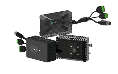
- LiDAR (Laser Radar): Provides high-precision point cloud data and distance measurement
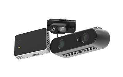
- D Camera (Depth Camera): Generates 3D depth maps for spatial understanding and object positioning
- RGB Camera: Captures visual information for feature-based SLAM
- IMU (Inertial Measurement Unit): Provides acceleration and angular velocity for motion estimation
Algorithm Layer
- Feature extraction and matching: Identifies key environmental points and matches them spatially
- Filtering and optimization: Uses Kalman filters or graph optimization to reduce sensor noise
- Path planning and obstacle avoidance: Computes optimal navigation routes based on map and sensor data
Decision Layer
- Enables dynamic environment perception and autonomous decision-making
- Supports multi-robot collaboration and intelligent task allocation
Advantages of Markerless Navigation Systems
Compared to traditional marker-based navigation systems, SLAM Robotique offers multiple advantages:
1. Lower Deployment and Maintenance Costs
Traditional AGV systems require magnetic strips, QR codes, or reflectors, increasing installation and maintenance costs. SLAM Robotique uses onboard sensors for environment perception, eliminating the need for external infrastructure.
2. Improved Environmental Adaptability
SLAM systems can dynamically update maps and adjust routes, allowing robots to operate smoothly even when warehouse layouts change frequently.
3. Higher Navigation Accuracy and Reliability
By combining visual SLAM and LiDAR SLAM, robots achieve high-precision localization, dynamic obstacle avoidance, and real-time path planning, even in complex industrial environments.
4. Multi-Robot Collaboration
SLAM Robotique supports shared mapping among multiple robots, enabling coordinated operations and improving overall efficiency and throughput.
Working Principle of SLAM Robotique
1. Environmental Perception
Robots collect environmental data using multiple sensors:
- LiDAR: Scans surroundings to generate 2D/3D point clouds
- D Camera: Captures depth maps for object recognition and modeling
- RGB Camera: Provides visual features for localization
- IMU: Supplies motion data such as speed, acceleration, and orientation
2. Feature Extraction and Matching
SLAM algorithms detect environmental features (corners, shelves, edges) and match them with previously built maps to achieve localization and map updates.
3. Map Updating and Path Planning
The system continuously updates maps and calculates optimal routes in real time, enabling autonomous navigation and obstacle avoidance.
Types of SLAM Robotique
Visual SLAM
Uses cameras to capture environmental images and performs localization through feature matching.
- Advantages: Low cost, rich visual data, easy AI integration
- Applications: Service robots, drones, AR/VR devices
LiDAR SLAM
Relies on laser scanning to generate high-precision point cloud maps.
- Advantages: High accuracy, stable in varying lighting conditions
- Applications: Industrial AGVs, AMRs, autonomous vehicles
Sensor Fusion SLAM
Combines vision, LiDAR, IMU, and depth sensing for improved accuracy and robustness.
- Advantages: Works in complex environments, supports dynamic obstacle avoidance and multi-robot systems
- Applications: Smart warehouses, industrial automation, autonomous driving systems

Real-World Applications of SLAM Robotique
1. Smart Warehousing and Logistics
AMRs use SLAM technology to:
- Transport goods automatically
- Perform real-time route planning
- Avoid dynamic obstacles
- Coordinate multiple robots
This significantly improves warehouse efficiency while reducing labor costs.
2. Smart Manufacturing
Industrial robots use SLAM navigation for:
- Material delivery
- Production line inspection
- Intelligent transport
- Flexible manufacturing
Helping companies transition toward Industry 4.0.
3. Service Robotics
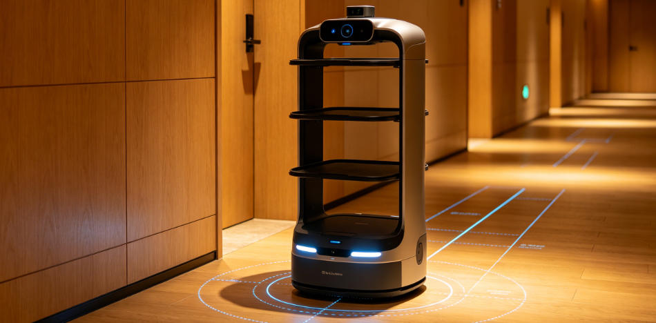
Robots in hotels, hospitals, and malls use SLAM Robotique for:
- Autonomous navigation
- Delivery services
- Smart guidance
- Environmental awareness
Improving customer experience and operational efficiency.
4. Autonomous Driving and Unmanned Systems
SLAM also plays a critical role in autonomous driving:
- Building real-time 3D environmental maps
- Detecting obstacles and road conditions
- Enabling precise localization and navigation
- Improving safety for unmanned systems
Development Trends of SLAM Robotique
With advances in AI, edge computing, and 3D vision sensors, SLAM systems are evolving toward greater intelligence and efficiency:
- AI-driven SLAM algorithms for adaptive environment understanding
- Real-time 3D mapping for complex environments
- Cloud-based map sharing for multi-robot collaboration
- Digital twin integration for smart factories
- Large-scale multi-robot SLAM coordination for logistics optimization
Why Choose SLAM Robotique?
- No physical markers required, reducing deployment costs
- High precision and reliability in complex environments
- Real-time map updates for dynamic scenarios
- Supports multi-robot collaboration
- Integrates with AI, depth cameras, and LiDAR for advanced intelligence
SLAM Robotique is not only a core technology for autonomous mobile robots but also a key driver of industrial automation, smart logistics, service robotics, and autonomous driving.
Synexens 3D Camera Of ToF Sensor Soild-State Lidar_CS20

Conclusion:
SLAM Robotique is a core technology enabling autonomous robot navigation, allowing robots to localize, map, and navigate unknown environments. Compared to traditional marker-based systems, it offers lower cost, higher flexibility, greater accuracy, and stronger adaptability. With continued advancements in AI and sensor technologies, SLAM Robotique will play an increasingly important role in Industry 4.0, smart logistics, and autonomous driving systems.
