

Améliorer la précision de la cartographie par drone avec les capteurs TOF : principaux avantages

Ces dernières années, l'utilisation des drones pour la cartographie et la topographie est devenue de plus en plus populaire en raison de leur capacité à couvrir rapidement et efficacement de vastes zones. Cependant, la précision des données collectées par ces drones est cruciale pour le succès de tout projet de cartographie ou de topographie. C'est ici que les capteurs de temps de vol (TOF) jouent un rôle essentiel.
Les capteurs TOF sont capables de mesurer la distance entre le drone et les objets ou le terrain qu'il survole en émettant des impulsions lumineuses et en mesurant le temps nécessaire à la lumière pour revenir. Ces informations sont ensuite utilisées pour créer des cartes 3D hautement précises de la zone en cours de topographie.
L'un des principaux avantages des capteurs TOF est leur capacité à mesurer la distance avec précision en temps réel. Cela signifie que même si le drone vole au-dessus d'un terrain irrégulier, les capteurs TOF peuvent toujours mesurer avec précision la distance entre le drone et le sol. Cela permet de garantir que les données collectées sont aussi précises que possible.
Les capteurs TOF sont également capables de mesurer des distances sur une large gamme, allant de quelques centimètres à plusieurs centaines de mètres. Cela les rend idéaux pour une large gamme d'applications de cartographie et de topographie, de la cartographie de haute résolution à courte distance à la topographie à grande échelle de villes entières.
Un autre avantage de l'utilisation des capteurs TOF dans la cartographie et la topographie par drone est leur capacité à fonctionner dans une gamme de conditions d'éclairage. Contrairement aux capteurs traditionnels qui dépendent de la lumière visible, les capteurs TOF peuvent fonctionner dans des conditions de faible luminosité, ce qui les rend idéaux pour une utilisation à l'aube ou au crépuscule, lorsque la visibilité est limitée.
L'utilisation des capteurs TOF dans la cartographie et la topographie par drone permet également de réduire le risque d'accidents ou de collisions avec des obstacles. En mesurant les distances avec précision, le drone peut naviguer en toute sécurité autour des obstacles et éviter les collisions. Cela aide non seulement à prévenir les dommages au drone, mais réduit également le risque de blessures pour les personnes ou de dommages à la propriété.
En conclusion, l'utilisation des capteurs TOF dans la cartographie et la topographie par drone devient de plus en plus importante en raison de leur capacité à fournir des données hautement précises en temps réel. Cela a le potentiel de révolutionner la manière dont nous cartographions et topographions de vastes zones, des environnements urbains aux zones sauvages reculées. Avec leur capacité à fonctionner dans une gamme de conditions d'éclairage et à mesurer les distances avec précision sur une large gamme, les capteurs TOF sont appelés à jouer un rôle crucial dans l'avenir de la cartographie et de la topographie par drone.
Expansion de l'utilisation de la technologie Time-of-Flight (ToF)
La technologie Time-of-Flight (ToF) ne se limite pas à améliorer la cartographie et la topographie par drone, elle transforme également des industries telles que les véhicules autonomes, la reconnaissance de gestes et les applications en temps réel.
ToF dans les véhicules autonomes
Dans les véhicules autonomes, les capteurs ToF aident à créer des images 3D précises de l'environnement, permettant la détection d'obstacles, la navigation et la prise de décision en temps réel. Ces capteurs sont essentiels pour un fonctionnement sécurisé, surtout dans des conditions de faible luminosité.
ToF dans la reconnaissance de gestes
Dans la reconnaissance de gestes, les caméras ToF suivent les mouvements des mains et du corps avec précision, même dans des conditions de faible luminosité. Cela est bénéfique pour les jeux vidéo, les écrans interactifs et les interfaces sans contact dans les soins de santé et la sécurité.
Applications en temps réel
La force des capteurs ToF réside dans leur capacité à fournir des données en temps réel. Que ce soit pour la cartographie, la navigation de véhicules ou le contrôle des gestes, ils permettent des réponses rapides et précises, ce qui les rend idéaux pour des environnements dynamiques.
Impact futur
À mesure que la technologie ToF progresse, son rôle dans les systèmes de vision va se développer, révolutionnant des industries comme la robotique, les transports et l'interaction homme-ordinateur. Des véhicules autonomes à la topographie par drone, les capteurs ToF sont prêts à redéfinir la manière dont nous interagissons avec la technologie.
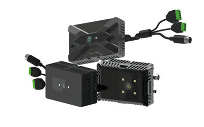
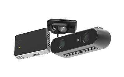
Capteur de profondeur 3D Synexens RGBD ToF — modèle CS30

Support après-vente :
Notre équipe technique professionnelle spécialisée dans la mesure avec des caméras 3D est prête à vous assister à tout moment. Que vous rencontriez des problèmes avec votre caméra TOF après l'achat ou que vous ayez besoin de clarifications sur la technologie TOF, n'hésitez pas à nous contacter à tout moment.
Nous nous engageons à fournir un service technique après-vente de haute qualité et une excellente expérience utilisateur, garantissant votre tranquillité d'esprit tant lors de l'achat que de l'utilisation de nos produits.
-
Publié dans
CS30