

TOF and LiDAR Technologies in Environmental and Geological Surveying
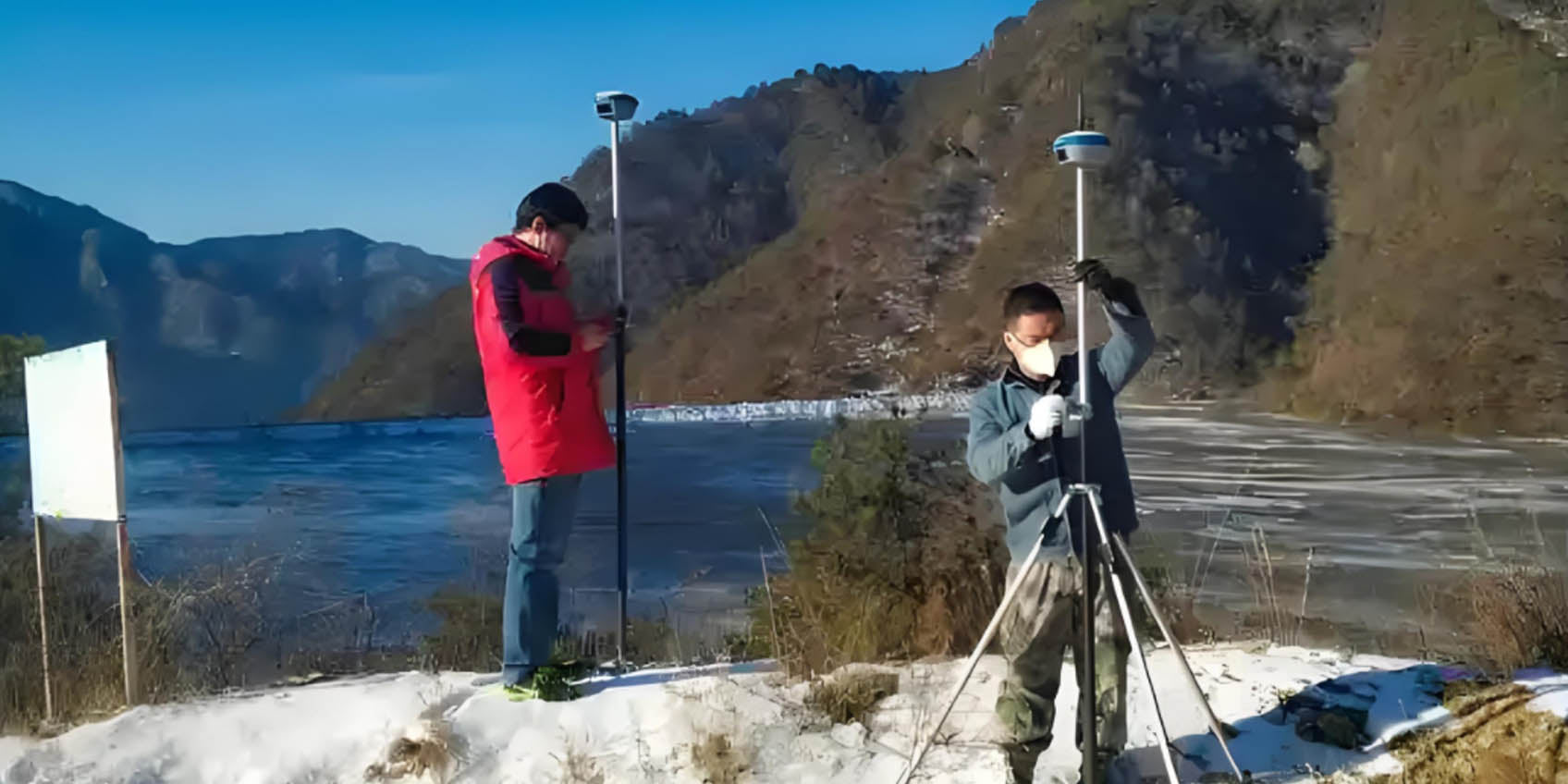
As the demand for environmental protection and geological surveying continues to grow, the need for efficient and precise terrain data collection is becoming increasingly critical. The combination of TOF (Time-of-Flight) technology and LiDAR (Light Detection and Ranging) technology has emerged as a key solution to meet this demand. Drones equipped with LiDAR systems and TOF sensors can not only acquire high-precision surface data in a short amount of time but also perform safe and efficient surveying in complex or hazardous environments. This article explores the application and advantages of combining TOF and LiDAR technologies in environmental and geological surveying.
What are TOF and LiDAR Technologies?
TOF (Time-of-Flight) technology is a distance-measuring technology based on the principle of light signal flight time. By measuring the time it takes for a light signal to travel from the sensor to the target and back, TOF sensors can precisely calculate the distance between the object and the sensor. The key advantage of TOF technology is its speed and accuracy, enabling rapid acquisition of precise distance data. TOF is especially suitable for complex or dynamic environments such as mountainous regions, forests, urban streets, or water bodies because it can overcome the limitations of traditional measurement methods in these settings.
TOF sensors work by accurately measuring the time taken for the light signal to travel, using the known speed of light to calculate the distance. This allows TOF technology to provide highly accurate measurements in a short period, especially during large-scale scans. Additionally, TOF technology is capable of functioning in low-light or nighttime environments, adapting to various complex conditions.
LiDAR (Light Detection and Ranging) technology, on the other hand, is a technique that uses laser pulses to obtain distance data. It works by emitting laser pulses and measuring the time it takes for the laser to travel to the target and return to the sensor, which allows for the calculation of precise three-dimensional coordinates. LiDAR technology offers extremely high spatial resolution and can accurately map the three-dimensional structure of objects. It is particularly adept at scanning various terrains and is widely used in applications such as topographic mapping, architectural design, forestry management, traffic monitoring, and disaster detection.
When drones are equipped with both LiDAR systems and TOF technology, they can quickly cover large areas and generate high-precision 3D maps. The combination of LiDAR and TOF provides the advantage of LiDAR's detailed terrain information while TOF technology offers precise distance measurements for large-scale, rapid surveys.
This enables drones to quickly scan extensive regions while accurately capturing fine details, providing strong support for subsequent data analysis and decision-making. This is particularly useful in hard-to-reach areas, such as mountains, forests, wetlands, etc., where TOF and LiDAR together allow drones to overcome ground obstacles and perform fast and safe data collection.
This technological combination enhances the accuracy and efficiency of terrain data collection and expands its application range, providing unprecedented solutions across various industries, from traditional Geographic Information Systems (GIS) to precision agriculture, environmental monitoring, and post-disaster assessments.

Applications in Environmental and Geological Surveying
-
Land Erosion Monitoring: Land erosion is a significant environmental issue, especially in mountainous areas, near rivers, and in urban outskirts. Through TOF technology, LiDAR-equipped drones can accurately measure terrain data in erosion-prone regions, such as riversides and slopes. Long-term data collection helps researchers assess the rate, extent, and environmental impact of land erosion. Additionally, TOF LiDAR technology can monitor the effectiveness of soil conservation measures, such as protective forests and vegetation coverage, providing scientific evidence for soil restoration and improvement.
-
Geological Disaster Monitoring and Assessment: Monitoring natural disasters like volcanic eruptions, landslides, and mudslides is critical for reducing losses. TOF LiDAR technology can help drones precisely capture terrain changes after a disaster, assessing the scale and impact of the event. Especially after a volcanic eruption, LiDAR drones can quickly scan the terrain around the volcano to assess dynamic changes in the crater and the spread of volcanic debris. For landslides and mudslide areas, TOF LiDAR drones can identify and assess affected regions, providing essential data for post-disaster reconstruction and early warning systems.
-
Wetland Protection and Ecological Restoration: Wetlands are crucial ecosystems that support biodiversity and provide services such as climate regulation, water storage, and water purification. However, wetland degradation and loss have severe environmental consequences. Drones equipped with TOF and LiDAR technology can conduct accurate mapping of wetlands, including area measurements, depth changes, and vegetation distribution. These data help assess wetland health and aid in developing effective protection and restoration measures. Moreover, the non-invasive nature of LiDAR drones makes them ideal for monitoring fragile ecosystems like wetlands without disrupting the environment.
-
Ecological Environment Monitoring: In remote and difficult-to-reach ecological regions, such as deserts, tropical rainforests, or high-altitude areas, traditional ground surveying methods are often challenging. Drones equipped with LiDAR and TOF sensors can easily overcome these challenges. They can quickly scan and collect high-precision 3D surface data, helping researchers understand vegetation distribution, terrain changes, and ecosystem health. Especially under the impact of climate change, monitoring ecological changes in remote regions is critical. TOF LiDAR drones can provide real-time data feedback, supporting environmental protection decisions and actions.
-
Post-Disaster Recovery Assessment: After natural disasters, drones equipped with TOF and LiDAR technology can swiftly assess damaged areas, providing precise 3D data. These data are essential for post-disaster recovery efforts, helping government agencies and emergency response teams understand terrain changes, infrastructure damage, and long-term environmental impacts. Whether it's landslides in mountainous areas after an earthquake or ground subsidence after flooding, LiDAR drones can provide accurate measurements, supporting recovery decision-making.

Advantages of Combining TOF and LiDAR Technologies
-
High-Precision Measurement: TOF technology can precisely measure the flight time of light signals, providing centimeter-level accuracy. When combined with LiDAR, it enables the rapid collection of high-precision surface data, ensuring the reliability and accuracy of measurement results.
-
Non-Invasive and Safe: Drones equipped with LiDAR and TOF technology do not need to physically contact the ground or objects, avoiding disruption to the ecological environment. This is especially important in fragile ecosystems such as wetlands, deserts, and forests.
-
Wide Area Coverage and Efficient Data Collection: Drones with LiDAR and TOF sensors can scan large areas in a short time, providing high-density 3D data and saving considerable time and labor costs, especially in areas that traditional ground surveys cannot reach.
-
Real-Time Data Processing and Analysis: Drones with TOF and LiDAR technology not only collect data efficiently but can also upload and process the data in real time. This allows researchers to immediately access measurement results for dynamic analysis and decision-making, significantly improving the efficiency of environmental monitoring and post-disaster response.
Conclusion
The combination of TOF and LiDAR technologies brings unprecedented innovation and progress to the field of environmental and geological surveying. Drone technology makes data collection in complex environments more efficient, precise, and safe. With continuous advancements in technology, TOF LiDAR drones will play an increasingly important role in environmental protection, ecological restoration, and post-disaster assessment, contributing to global sustainability and conservation goals.
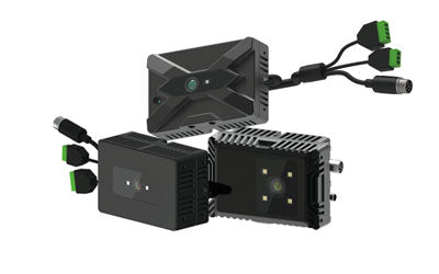
Synexens 3D Of RGBD ToF Depth Sensor_CS30

Our professional technical team specializing in 3D camera ranging is ready to assist you at any time. Whether you encounter any issues with your TOF camera after purchase or need clarification on TOF technology, feel free to contact us anytime. We are committed to providing high-quality technical after-sales service and user experience, ensuring your peace of mind in both shopping and using our products.
-
Publicado en
CS30