

How ToF Sensors Improve UAV Mapping & 3D Environmental Monitoring
Why are ToF sensors becoming the best depth sensing solution for UAV mapping and environmental monitoring?
Background: The Rapid Rise of UAVs in Mapping, Forestry, and Environmental Applications
With the rapid advancement of drone technology, UAVs (Unmanned Aerial Vehicles) have become essential tools in mapping, forestry surveys, environmental monitoring, and smart agriculture. Equipped with advanced sensor systems, drones can efficiently and precisely collect geospatial data. Compared with traditional manual surveying and satellite remote sensing, UAVs enable low-altitude flight, flexible deployment, and high-resolution data acquisition—providing reliable datasets for forest management, river and lake monitoring, and ecological protection.
In drone applications, sensors are the core of data acquisition. With the evolution of 3D perception technology, TOF (Time-of-Flight) sensors and 3D ToF depth sensors have emerged as key enablers for intelligent mapping and environmental monitoring. By capturing accurate real-time depth data, ToF technology empowers drones with 3D spatial awareness, driving their transformation toward automation and intelligence.
What is a 3D ToF Sensor?
A 3D ToF (Time-of-Flight) sensor is a three-dimensional depth-sensing device based on the principle of light’s flight time. It measures the distance between the sensor and an object by emitting modulated light—usually infrared—and calculating the time it takes for the light to reflect back from the object’s surface.
Formula:
Through this method, the sensor generates accurate 3D spatial data, enabling applications that require real-time distance measurement and depth mapping.

Typical ToF Applications in Drones
1. Terrain Modeling and 3D Mapping
Drones equipped with 3D ToF modules can rapidly produce high-precision elevation and terrain data for accurate geospatial modeling. By emitting infrared light pulses and measuring the return time, ToF sensors capture the real-time distance to every ground point, generating detailed 3D point clouds and terrain models. This makes ToF technology ideal for surveying complex terrains such as mountains, valleys, hills, and urban structures.
Compared to traditional photogrammetry or GPS elevation methods, UAVs with 3D ToF depth sensors achieve millimeter- to centimeter-level accuracy, making them suitable for engineering surveys, urban planning, road construction, and disaster response. Their real-time modeling capability allows drones to generate 3D maps during flight, improving survey efficiency and enabling multi-route data merging for comprehensive GIS datasets.
Thanks to their active illumination and anti-interference capabilities, ToF sensors excel in challenging environments such as dense forests, urban canyons, or reflective water surfaces—ensuring consistent, high-quality depth data collection under varying light conditions.
2. Vegetation Height and Forestry Resource Monitoring
In forestry and ecological monitoring, drones equipped with 3D ToF camera modules can measure vegetation height and analyze forest density with high precision. By capturing real-time 3D depth information, ToF sensors calculate tree height, crown width, and canopy density, producing 3D maps of forest distribution, coverage, and structure—critical for forest health assessment, pest control, and natural disaster prevention.
Compared with LiDAR systems, ToF sensors are lighter, more energy-efficient, and easier to integrate, allowing drones to conduct longer missions with lower energy consumption. Using 3D point cloud data, drones can generate accurate vegetation height models and track forest changes over time. By comparing ToF datasets collected at different intervals, forest managers can assess growth trends and design optimized management or conservation plans.
When integrated with AI-based analytics, ToF sensors enable automated classification of forest types, health evaluation, and early disaster warnings—greatly enhancing UAV performance in forestry and environmental applications.
3. Water Monitoring and Environmental Protection
ToF-equipped drones excel in monitoring water bodies, wetlands, rivers, and lakes for environmental assessment. By capturing 3D depth information of water surface height, depth variations, and surrounding terrain, ToF modules generate accurate 3D water body point clouds and models for flood management, water resource planning, and ecological studies.
Using ToF technology, drones can cover vast areas quickly and cost-effectively. In river or wetland monitoring, ToF sensors detect water level fluctuations, flooding zones, and pollution sources, providing critical data for ecological protection and disaster prevention. Combined with AI algorithms, UAVs can analyze pollution levels, estimate algal density, and predict water quality trends, advancing intelligent environmental monitoring.
ToF’s strong resistance to light interference and environmental noise allows stable operation in bright sunlight, reflections, or dynamic water surfaces—making it a reliable depth-sensing solution for outdoor environmental missions.

Technical Advantages: Lightweight Design, Real-Time Depth Data, and Environmental Adaptability
In UAV-based mapping, forestry, and environmental research, ToF sensors (Time-of-Flight Sensors) have become one of the most promising 3D sensing solutions due to their lightweight structure, real-time depth output, and strong environmental adaptability. These features allow 3D ToF Sensors, 3D ToF Modules, and ToF Camera Modules to increasingly replace certain LiDAR systems, offering a more efficient and scalable alternative for UAV applications.
-
Lightweight Design for Easy UAV Integration
ToF modules are smaller, lighter, and more power-efficient than traditional LiDAR systems, minimizing UAV payload stress. This makes lightweight ToF sensors ideal for compact or consumer-grade drones, extending flight endurance and enabling professional-grade depth sensing. -
Real-Time 3D Depth Output for Dynamic Flight Modeling
During flight, drones use ToF sensors to continuously output high-precision 3D point cloud data, supporting obstacle avoidance, 3D mapping, and path planning. The millisecond-level response of ToF’s flight-time mechanism ensures accurate sensing even during high-speed maneuvers—making it a key component for autonomous navigation, SLAM, and complex aerial surveys. -
Strong Adaptability to Complex Environments
Using active illumination, ToF sensors operate reliably in varying light conditions, including strong sunlight, shadows, or nighttime. Even in challenging scenarios like forest canopies, glass reflections, or water surfaces, ToF maintains high depth accuracy, enhancing drone reliability in real-world missions. -
Cost Efficiency for Scalable Adoption
Compared with LiDAR, ToF sensor modules offer lower cost, easier integration, and simpler maintenance—reducing the entry barrier for UAV manufacturers. This cost efficiency promotes large-scale adoption of 3D sensing capabilities in commercial, industrial, and research drones, accelerating the shift from GPS and vision-based navigation to intelligent 3D depth perception.
Technical Challenges: Vibration Impact, Light Interference, and Endurance Limitations
Although ToF (Time of Flight) depth-sensing technology demonstrates significant advantages in UAV 3D mapping, environmental monitoring, terrain modeling, and forestry measurement, several technical and engineering challenges still hinder its large-scale adoption. The most critical issues are related to ToF measurement accuracy, vibration interference, outdoor light disturbance, and endurance optimization.
-
Vibration and Flight Shaking Affect Depth Stability
UAVs experience high-frequency vibrations during rapid flight, acceleration, braking, or under wind turbulence, which can introduce measurement errors in ToF distance sensing and reduce the stability of point cloud data. To ensure accurate depth reconstruction, systems must employ high-stability gimbals, anti-vibration mounts, filtering algorithms, and IMU + ToF fusion compensation methods to improve consistency and repeatability in long-range sensing. -
Light Interference in Outdoor Environments Causes Measurement Errors
UAVs often operate in environments with strong sunlight, mirror reflections, building glass, or water surface glare, all of which affect ToF depth accuracy and signal reliability. To minimize the impact of strong light interference on ToF performance, systems can adopt multi-frequency modulation, narrow-band optical filters, active + ambient light fusion correction algorithms, and AI-based denoising models to maintain robustness in highly dynamic outdoor lighting conditions. -
Limited Endurance for Long-Duration Mapping Missions
Although ToF depth camera modules consume less power than LiDAR, they are still active light-emitting systems, which can increase overall energy usage during prolonged UAV operations. Balancing ToF power consumption and UAV flight endurance is crucial for large-area mapping missions. To overcome this, UAV manufacturers and engineers can adopt strategies such as low-power ToF module selection, optimized battery management, flight path optimization, and segment-based data acquisition, ensuring full coverage without mid-mission data interruptions.
In summary, the practical deployment of ToF-based UAV systems requires continued optimization in anti-vibration design, light interference handling, and endurance performance. Overcoming these challenges will accelerate the widespread adoption of UAV ToF depth sensing in applications such as agricultural mapping, forestry monitoring, environmental observation, and smart city digitization.

Manufacturer Recommendations: Optimizing Module Selection, AI Data Processing, and Sensor Fusion
When integrating ToF technology into UAVs, manufacturers should consider:
-
Module Selection Optimization – Choose appropriate ToF sensors or 3D ToF modules based on UAV payload, measurement range, and task requirements.
-
AI Data Processing – Use edge AI or cloud computing for point cloud denoising, classification, and terrain reconstruction to enable smarter analytics.
-
Sensor Fusion – Combine ToF sensors with RGB cameras, IMUs, GPS, and LiDAR to achieve high-precision, multi-source environmental perception.
Keywords: UAV ToF module selection, AI data processing, sensor fusion, edge computing UAV.
Outlook: Building Intelligent UAV Monitoring Systems with ToF + AI + 5G
With advancements in AI algorithms, 5G connectivity, and high-performance ToF modules, UAV applications in mapping and environmental monitoring are becoming increasingly intelligent and data-driven:
-
Real-Time Data Transmission and Cloud Analysis – Using 5G networks, UAVs can stream 3D point cloud and environmental data to cloud platforms for real-time analysis and decision-making.
-
AI-Based Recognition and Prediction – Deep learning algorithms can automatically analyze terrain, vegetation, and water body data to generate reports and detect anomalies.
-
All-Scenario Smart Monitoring – Enables cross-domain applications for forestry, agriculture, water management, urban infrastructure, and environmental protection.
Keywords: ToF + AI + 5G, intelligent UAV monitoring, real-time 3D point cloud analysis, environmental monitoring UAV, smart forestry drone.
Conclusion
As the demand for UAV-based mapping and environmental monitoring continues to rise, ToF sensors and 3D ToF technology are emerging as core enablers of UAV intelligence. Through lightweight design, real-time 3D point cloud acquisition, high light-interference resistance, and AI-driven data analysis, ToF technology provides UAVs with precise depth perception and spatial awareness. These advancements are empowering UAVs to operate across diverse applications, including forestry, environmental protection, surveying, and smart agriculture.
In the near future, the integration of 5G networks, AI analytics, and ToF technology will usher UAVs into a new era of intelligent, real-time, and fully autonomous 3D sensing and monitoring.
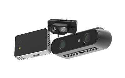
Synexens 3D Of RGBD ToF Depth Sensor_CS30

Our professional technical team specializing in 3D camera ranging is ready to assist you at any time. Whether you encounter any issues with your TOF camera after purchase or need clarification on TOF technology, feel free to contact us anytime. We are committed to providing high-quality technical after-sales service and user experience, ensuring your peace of mind in both shopping and using our products.