

How Does SLAM Robot Navigation Enable Markerless Localization?
How Does SLAM Help Robots Navigate Without Markers?
With the rapid development of artificial intelligence (AI), robotics, computer vision, and smart manufacturing industries, robots are gradually evolving from traditional automation devices that follow fixed paths into intelligent systems capable of autonomous perception, decision-making, and movement. In applications such as AMR autonomous mobile robots (Autonomous Mobile Robots) in smart warehouses, AGV automated guided vehicles (Automated Guided Vehicles) in industrial production, and service robots, accurate positioning and environmental understanding have become key factors determining robot intelligence.
For robots to achieve truly autonomous movement, they must answer two fundamental questions: 'Where am I?' and 'What does my surrounding environment look like?' This is exactly the problem that SLAM (Simultaneous Localization and Mapping) technology aims to solve and has become one of the most important technologies in modern robot navigation. Compared with traditional positioning solutions that rely on QR codes, magnetic strips, reflectors, or artificial markers, Markerless SLAM allows robots to achieve real-time localization, map creation, and autonomous navigation without requiring additional environmental modifications.
In the global robotics industry, slam robótica (robotics SLAM technology) has become a key foundation for advancing intelligent robots, industrial automation, smart logistics, and future embodied intelligence systems.
What Is SLAM? Why Do Robots Need SLAM Navigation?
SLAM (Simultaneous Localization and Mapping) is a core technology that enables robots to achieve autonomous localization and environmental mapping in unknown or dynamic environments. Simply put, SLAM gives robots a spatial perception ability similar to humans, allowing them to continuously observe the surrounding world through sensors, determine their own position, and gradually build an environmental map that can be used for navigation.
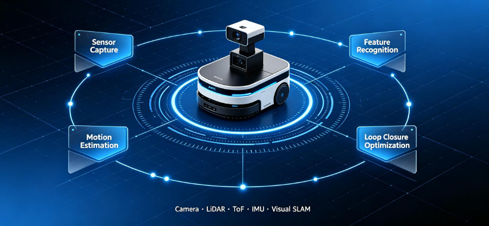
For example, when a person enters an unfamiliar building for the first time, the human brain uses visual information to observe walls, doors, furniture, and other environmental features while combining movement direction and spatial memory to understand “where I am” and gradually build an understanding of the entire space. Robots do not have human intelligence, so they rely on hardware devices such as cameras, LiDAR sensors, IMU inertial sensors, and ToF depth cameras to collect environmental data and then use SLAM algorithms for computation and analysis to achieve similar spatial awareness.
For modern intelligent robots, SLAM is not just a positioning technology; it is the foundation for autonomous movement, intelligent decision-making, and environmental understanding. Whether it is an AMR autonomous mobile robot (Autonomous Mobile Robot) used in smart warehouses or an AGV automated guided vehicle (Automated Guided Vehicle) used in industrial manufacturing, accurate navigation depends heavily on SLAM technology.
Traditional robots often rely on fixed routes, magnetic tracks, QR code markers, reflectors, or manually installed positioning points. Although these methods are simple and reliable, they have significant limitations in large-scale and constantly changing environments. For example, in smart factories, production equipment may be relocated, warehouse layouts may change, and workers or logistics vehicles may move frequently. If robots depend on fixed markers, the entire positioning system may need to be redeployed. In contrast, SLAM-based robot navigation systems can continuously perceive environmental changes and adapt to complex scenarios through autonomous mapping and dynamic localization.

From a technical perspective, SLAM systems solve two fundamental problems:
First, where is the robot? (Localization)
The robot needs to calculate its real-time position and orientation within the environment, including:
- Current coordinates;
- Movement direction;
- Rotation angle;
- Motion trajectory.
For example, when an AMR robot transports goods inside a warehouse, it needs to accurately know which storage area it is located in, how far it is from the destination, and which route it should take.
Second, what does the surrounding environment look like? (Mapping)
The robot not only needs to know its own position but also understand the surrounding spatial structure. SLAM systems use sensor data to build maps containing:
- Wall and obstacle locations;
- Corridor structures;
- Equipment layouts;
- Navigable areas.
As the robot continues moving, the map is continuously updated, allowing the robot to perform autonomous navigation even in unknown environments.
A complete SLAM robot navigation system usually consists of several key technology modules:
1. Sensor Data Acquisition
First, robots need to collect external environmental information through different sensors.
Among them, Camera vision sensors are an important component of Visual SLAM. They capture continuous images and analyze environmental features such as corners, textures, and object edges.
LiDAR sensors obtain spatial distance information by emitting laser signals and measuring reflected signals. They provide highly accurate point cloud data and are widely used in autonomous driving, industrial robots, and large mobile robots.
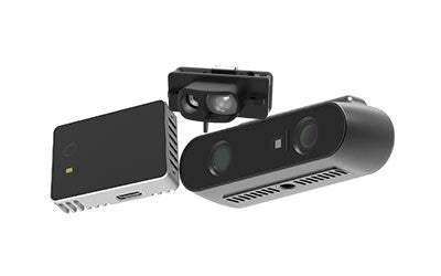
ToF depth cameras (Time of Flight Cameras) have also become an important sensor technology for SLAM robot navigation in recent years. ToF technology calculates depth information by measuring the flight time of light signals and can directly generate 3D spatial data. Compared with traditional RGB cameras, ToF Cameras provide more accurate distance information, helping robots build more stable 3D maps. Therefore, they are widely used in 3D vision, robot navigation, human detection, and smart manufacturing applications.
IMU inertial sensors detect robot acceleration and rotation changes, providing motion state information for SLAM algorithms and improving localization stability in dynamic environments.
2. Feature Extraction and Environmental Understanding
After collecting environmental data, robots need to identify stable spatial features from large amounts of information.
Examples include:
- Wall edges;
- Column structures;
- Shelf patterns;
- Ceiling textures;
- Fixed architectural elements.
These features become important references for robot localization.
In Visual SLAM, algorithms use image processing techniques to detect key feature points and compare image changes over time to estimate robot movement distance and direction.
3. Motion Estimation
When robots move, SLAM algorithms continuously calculate:
“How far has the robot moved?”
“Where is the robot currently located?”
For example, when a robot moves from point A to point B, the system compares environmental data collected at different moments and uses mathematical models to estimate the robot’s movement trajectory.
This process usually combines:
- Visual information;
- Depth data;
- IMU data;
Through multi-sensor fusion, SLAM systems can achieve higher positioning accuracy.
4. Map Optimization and Loop Closure
Because robots accumulate positioning errors during long-term operation, SLAM systems need continuous map optimization.
Among these technologies, Loop Closure Detection is one of the most important components of SLAM.
For example, when a robot operates in a large warehouse for several hours and returns to a previously visited location, the system can recognize:
“This is the same area I visited before.”
It then uses this information to correct previous localization errors and improve overall map accuracy.
Why Do Robots Need SLAM Navigation?
As robots expand from controlled industrial environments into open and complex real-world scenarios, the importance of SLAM continues to grow.
1. Achieving True Autonomous Mobility
Without SLAM, robots can only follow predefined routes. With SLAM, robots can explore environments, plan paths, and avoid obstacles independently.
2. Reducing Deployment Costs
Markerless SLAM eliminates the need for large-scale installation of QR codes, magnetic tracks, or positioning devices, allowing robots to operate directly in existing environments.
3. Improving Environmental Adaptability
When facing moving people, changing equipment, or modified layouts, SLAM robots can update maps in real time and maintain stable operation.
4. Supporting the Future Development of Intelligent Robots
Future humanoid robots, service robots, and industrial robots require not only mobility but also the ability to understand the real world. SLAM will become a fundamental technology enabling robots to achieve spatial intelligence.
Therefore, SLAM technology is not only a robot localization method but also an essential bridge connecting robots with the physical environment. By combining AI vision, 3D vision sensors, ToF depth cameras, and multi-sensor fusion technologies, SLAM robots can achieve more accurate, efficient, and intelligent autonomous navigation, providing critical support for smart manufacturing, intelligent logistics, autonomous driving, and future embodied AI robots.
Core Sensor Technologies in SLAM Systems
Robot SLAM navigation depends heavily on high-quality environmental perception capabilities. Modern SLAM systems typically adopt multi-sensor fusion architectures.
Cameras are the foundation of Visual SLAM. By continuously capturing images and analyzing environmental features, cameras help estimate robot position. Compared with simple distance sensors, vision systems provide richer information, including object shapes, colors, and environmental structures, making them widely used in service robots, delivery robots, and intelligent devices.
LiDAR sensors measure spatial distances by transmitting laser signals and analyzing reflection times. They provide high accuracy and strong environmental adaptability, making them popular in autonomous vehicles, industrial robots, and large warehouse robots.
ToF depth cameras have become increasingly important in SLAM robot navigation. By calculating the flight time of light signals, ToF technology provides depth information and generates 3D spatial data. Compared with RGB cameras, ToF Cameras provide more precise distance measurements, helping robots create more stable 3D maps. They are widely applied in 3D vision, robot navigation, human detection, and smart manufacturing.
IMU inertial sensors detect acceleration and rotation changes, providing attitude information for SLAM algorithms and improving localization stability.
How Does SLAM Algorithm Enable Autonomous Robot Localization?
SLAM is not simply about recording the environment; it is a complex data processing system.
First, robots extract environmental features from sensor data, such as corners, shelf edges, door frames, and architectural structures. These stable features become important references for robot localization.
Next, SLAM algorithms analyze robot movement changes through continuous images or point cloud data, calculating movement direction and distance. When a robot moves from one location to another, the algorithm compares environmental information collected at different time points to estimate the robot’s motion trajectory.
Because long-term operation creates accumulated errors, SLAM systems use technologies such as Loop Closure Detection and map optimization to correct positioning errors. When a robot returns to a previously visited location, the system recognizes the same environmental features and automatically adjusts the map to improve localization accuracy.

What Is Markerless SLAM? Why Do Future Robots Need Markerless Localization?
Traditional robot navigation usually relies on external positioning infrastructure, including QR code markers, magnetic navigation tracks, reflectors, and UWB positioning systems. Although these solutions are mature, they face limitations in large-scale smart factories and dynamic warehouse environments.
First, large deployments require many positioning devices, increasing infrastructure costs. Second, when warehouse layouts change, such as moving shelves, adjusting equipment, or redesigning production areas, traditional positioning systems may require redevelopment.
Markerless SLAM changes this approach. Robots use visual information, depth data, and AI algorithms to understand the environment without requiring artificial markers, enabling autonomous localization.
This approach provides three major advantages:
First, it reduces deployment costs. Companies can deploy robots without modifying existing environments.
Second, it improves environmental adaptability. Robots can update maps in real time and handle dynamic changes.
Third, it supports large-scale robot deployment. Future smart factories may operate hundreds of AMR robots simultaneously, and markerless SLAM provides a more flexible management solution.
How Does Visual SLAM Improve Robot Intelligence?
Visual SLAM is one of the most important development directions in robotics. It uses cameras and computer vision algorithms to achieve localization and mapping.
Compared with traditional navigation methods, Visual SLAM not only measures distance but also understands environmental content. For example, robots can detect whether people, equipment, or obstacles are ahead and adjust movement strategies according to environmental changes.
Therefore, Visual SLAM is widely used in:
- Smart warehouse robots;
- Autonomous delivery robots;
- Humanoid robots;
- Autonomous driving systems;
- AR/VR spatial computing.
With the development of artificial intelligence, Visual SLAM is evolving from simple positioning technology into a spatial intelligence technology capable of understanding environments.
Ceiling Vision SLAM: Using Ceiling Structures for Stable Robot Localization
In industrial warehouse environments, traditional robots usually observe ground-level surroundings for localization. However, ground environments are often affected by dynamic factors such as moving workers, stored goods, and equipment changes.
Therefore, Ceiling Vision SLAM has become a new solution.
This technology uses upward-facing vision sensors to capture ceiling structures, lighting positions, and architectural features to achieve robot localization.
Compared with ground environments, ceilings are usually more stable:
- Less affected by obstacles;
- Minimal long-term structural changes;
- Not influenced by people and goods movement.
Therefore, ceiling vision SLAM is particularly suitable for smart warehouses, industrial logistics, medical robots, and commercial service robots.
How Does SLAM Robot Navigation Drive AGV and AMR Development?
AGV and AMR are both important components of modern intelligent logistics, but their biggest difference lies in autonomous capability.
Traditional AGVs usually rely on magnetic tracks, rails, or fixed routes, making them suitable for stable industrial environments.
AMR robots, however, use SLAM technology to autonomously build maps, plan routes, and avoid obstacles. For example, when an AMR detects that a path is blocked, it can automatically calculate a new route instead of waiting for human intervention.
Therefore, SLAM is accelerating the transformation of traditional AGVs into more intelligent AMR systems.
Future Trends of Slam Robótica: The Integration of AI, 3D Vision, and Spatial Intelligence
Future robot navigation technology will go beyond positioning and movement and evolve toward advanced spatial intelligence.
SLAM will integrate with AI vision, digital twins, multi-sensor fusion, and edge computing technologies, enabling robots to achieve:
- Stronger environmental understanding;
- More accurate autonomous navigation;
- More complex task execution.
For example, in smart manufacturing, robots can use SLAM to create digital factory maps and combine them with AI algorithms for collaborative production. In intelligent logistics, AMR robots can automatically adjust transportation routes according to real-time environments, improving warehouse efficiency.
With the continuous development of Visual SLAM, Markerless SLAM, ToF depth cameras, and slam robótica technology, future robots will gain spatial perception capabilities closer to human intelligence and achieve truly autonomous movement and intelligent decision-making.
Conclusion
SLAM technology is redefining robot navigation. From traditional positioning systems based on artificial markers to modern AI vision and depth perception-based Markerless SLAM systems, robots are becoming more flexible, intelligent, and autonomous.
Whether in smart warehouses with AMR robots or future humanoid robots, SLAM will become a critical technology bridge connecting robots with the real world.
In the future, with the development of SLAM, AI Vision, 3D vision sensors, and robot operating systems, robots will play an increasingly important role in industrial automation, intelligent logistics, smart cities, and next-generation intelligent applications.
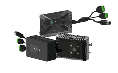
Synexens Industrial Outdoor 4m TOF Sensor Depth 3D Camera Rangefinder_CS40p

