

SLAM Navigation: Principles, Applications, and Industrial Use Cases

What Is SLAM Navigation and Why Is It Essential for Industrial Robots?
The Evolution of SLAM Navigation Technology
SLAM (Simultaneous Localization and Mapping) has experienced rapid development since it was first proposed in 1988. Originally designed for military and defense robotics, SLAM technology enabled autonomous systems such as drones and reconnaissance robots to navigate unfamiliar and GPS-denied environments.
As computing power, sensors, and algorithms advanced, SLAM navigation gradually transitioned into civilian and industrial applications, including:
-
Autonomous mobile robots (AMR)
-
Automated guided vehicles (AGV)
-
Robotic vacuum cleaners
-
Autonomous driving systems
-
Augmented reality (AR) and mixed reality (MR)
Today, SLAM has become a core technology for autonomous navigation, significantly improving robot intelligence, navigation accuracy, and operational efficiency across industries such as logistics, manufacturing, automotive, and warehousing.
What Is SLAM Navigation?
SLAM navigation refers to a robot’s ability to simultaneously determine its own position (localization) while building a map of an unknown environment, without relying on pre-installed infrastructure or external positioning systems like GPS.
By fusing data from sensors such as:
-
Cameras (RGB / depth / stereo)
-
LiDAR
-
IMU (Inertial Measurement Units)
SLAM systems process environmental information using advanced algorithms to generate accurate maps and real-time pose estimation.
This capability solves the classic 'chicken-and-egg' problem in robotics:
A robot needs a map to localize itself, but it also needs to know its location to build the map.
SLAM elegantly resolves this contradiction, making it indispensable for indoor navigation, underground environments, and dynamic industrial scenes.

Core Architecture of SLAM Systems
A typical SLAM system consists of two fundamental modules:
1. SLAM Front-End (Perception & Estimation)
The front-end handles raw sensor data processing, including:
-
Feature extraction and matching
-
Motion estimation and odometry
-
Sensor data association
This stage provides an initial estimate of the robot’s position and environment structure.
2. SLAM Back-End (Optimization & Mapping)
The back-end focuses on global consistency by:
-
Optimizing pose graphs
-
Reducing accumulated drift
-
Refining map accuracy
Together, these modules ensure both real-time performance and long-term localization stability, which are critical for industrial-grade SLAM navigation solutions.

Types of SLAM Based on Sensors
Visual SLAM
Visual SLAM relies on monocular, stereo, or RGB-D cameras to extract visual features from images. It is widely used in:
-
Indoor robots
-
AR/VR systems
-
Consumer robotics
Advantages include low hardware cost and rich environmental information, but performance can be affected by lighting changes and texture-poor environments.
LiDAR-Based SLAM
LiDAR SLAM uses laser scanners to capture precise 3D structural information. It offers:
-
High accuracy
-
Strong robustness to lighting conditions
-
Reliable performance in large-scale environments
However, traditional LiDAR SLAM may struggle in highly dynamic or cluttered indoor scenarios.
IMU-Based SLAM
IMU-based SLAM focuses on inertial data for motion estimation and is commonly used as a complementary sensor to improve robustness, especially during rapid motion or sensor occlusion.
Why Is SLAM Navigation So Important?
Autonomous Navigation Without GPS
SLAM enables robots to operate independently in GPS-denied environments, such as warehouses, factories, underground tunnels, and indoor facilities.
Enhanced Environmental Perception
By continuously mapping surroundings, SLAM systems allow robots to detect obstacles, recognize structural changes, and avoid collisions in real time.
Intelligent Path Planning
Accurate maps generated through SLAM enable optimal route planning, improving efficiency, safety, and task execution speed.
Higher Mission Success Rates
In applications like inspection, logistics, surveillance, and rescue, precise localization ensures reliable task completion even in dynamic environments.
Strong Adaptability
Modern SLAM systems can handle:
-
Variable lighting
-
Human-robot mixed traffic
-
Layout changes
-
Narrow aisles and complex structures
Cost-Effective Deployment
Compared with navigation methods requiring magnetic strips, QR codes, or fixed landmarks, SLAM navigation reduces infrastructure costs and simplifies system deployment.

SLAM Navigation in GPS-Denied Environments
In indoor or underground settings where GPS is unavailable, SLAM-based indoor positioning becomes essential.
-
Visual SLAM uses feature matching and motion estimation to track position.
-
LiDAR SLAM analyzes reflected laser signals to build accurate spatial models.
These approaches allow robots to maintain stable localization even in large, complex spaces.
Key Applications of SLAM Navigation
Autonomous Driving
SLAM plays a critical role in autonomous vehicle localization and perception, enabling precise navigation across urban roads, highways, and complex traffic environments by fusing camera and LiDAR data.
Mobile Robot Navigation
In industrial and service robotics, SLAM-based robot navigation allows AMRs and AGVs to autonomously perform tasks such as material transport, inspection, and cleaning.
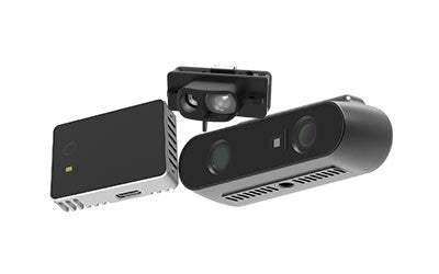
MeierVision’s top-view SLAM navigation solution introduces a unique approach by using 3D cameras to scan overhead features, eliminating dependence on floor-based markers and improving robustness in cluttered environments.
Robotic Vacuum Cleaners
SLAM enables robotic vacuums to map homes, plan efficient cleaning routes, and avoid obstacles—significantly improving cleaning coverage and intelligence.
Top-View SLAM Navigation: A New Paradigm
Top-view SLAM leverages ceiling and overhead structural features for localization and mapping. MeierVision’s solution integrates:
-
3D vision sensors
-
Deep learning networks
-
Extensive industrial training datasets
This approach excels in environments such as:
-
Warehouses with ceiling heights from 2–12 meters
-
Long, narrow aisles
-
Dynamic industrial floors with frequent layout changes
Compared to traditional navigation methods, top-view SLAM offers higher stability, scalability, and long-term accuracy.
Industry Use Cases of SLAM Navigation
Case 1: Smart Logistics in the Photovoltaic Industry
In a photovoltaic factory covering 80,000 m², over 500 AGVs equipped with MRDVS top-view SLAM operate continuously. Despite heavy material flow and frequent environmental changes, the system has achieved zero localization failures for over one year.
Case 2: Automotive Manufacturing
An automotive plant in southern China deploys MRDVS SLAM navigation for large AMRs transporting engine components. The system performs reliably in human-vehicle mixed traffic and rapidly changing production layouts.
Case 3: Dense Warehouse Operations
In a garment warehouse with over 4,000 high-density storage locations, traditional 2D LiDAR navigation struggled. MRDVS SLAM enabled AGV forklifts to operate efficiently despite dynamic inventory changes and narrow aisles.
Conclusion: The Future of SLAM Navigation
SLAM navigation has become the backbone of modern autonomous systems, enabling accurate localization, intelligent mapping, and efficient navigation in complex environments.
From autonomous vehicles to industrial robots, SLAM continues to expand the boundaries of automation.
MeierVision’s top-view SLAM navigation solution represents the next generation of SLAM technology—delivering unmatched precision, adaptability, and scalability for industrial automation. By addressing real-world challenges in dynamic environments, MeierVision is shaping a smarter, safer, and more efficient future for autonomous navigation.
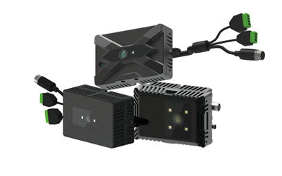
Synexens Industrial Outdoor 4m TOF Sensor Depth 3D Camera Rangefinder_CS40p

After-sales Support:
Our professional technical team specializing in 3D camera ranging is ready to assist you at any time. Whether you encounter any issues with your TOF camera after purchase or need clarification on TOF technology, feel free to contact us anytime. We are committed to providing high-quality technical after-sales service and user experience, ensuring your peace of mind in both shopping and using our products.
-
Posted in
CS40P