

Time-of-Flight (ToF): Powering LiDAR Drones & Environmental Perception
Amid the rapid evolution of modern technology, ToF (Time-of-Flight) has emerged as a foundational technology for LiDAR (Light Detection and Ranging) sensors and drone systems. From environmental perception to autonomous driving, and from 3D mapping to precise distance measurement, ToF technology is driving a revolution in intelligent flight systems.
What is ToF? The Core Principle of Time-of-Flight
ToF is an optical distance measurement technology that emits light signals (such as infrared or laser) and calculates the time it takes for the signal to travel to a target and return. This time of flight is then converted into an accurate distance measurement.
This principle is widely applied in various devices relying on flight-based measurement systems, especially in scenarios requiring precise spatial perception, such as LiDAR, depth cameras, and environmental monitoring sensors.
LiDAR and ToF: The 'Eyes' of Precision for Drones
What is a LiDAR Sensor?
LiDAR (Light Detection and Ranging) is an advanced optical distance measurement system that sends out high-frequency laser pulses and receives the reflected signals to measure the distance between an object and the sensor. Its core ranging mechanism is based on ToF, using the time delay of the laser pulse to calculate exact spatial distances.
LiDAR can produce not only 2D depth maps but also high-density 3D point cloud images, making it widely applicable in terrain reconstruction, obstacle detection, and dynamic target tracking. With its high accuracy, resolution, and anti-interference performance, it has become indispensable in cutting-edge fields like autonomous driving, surveying, and smart infrastructure.

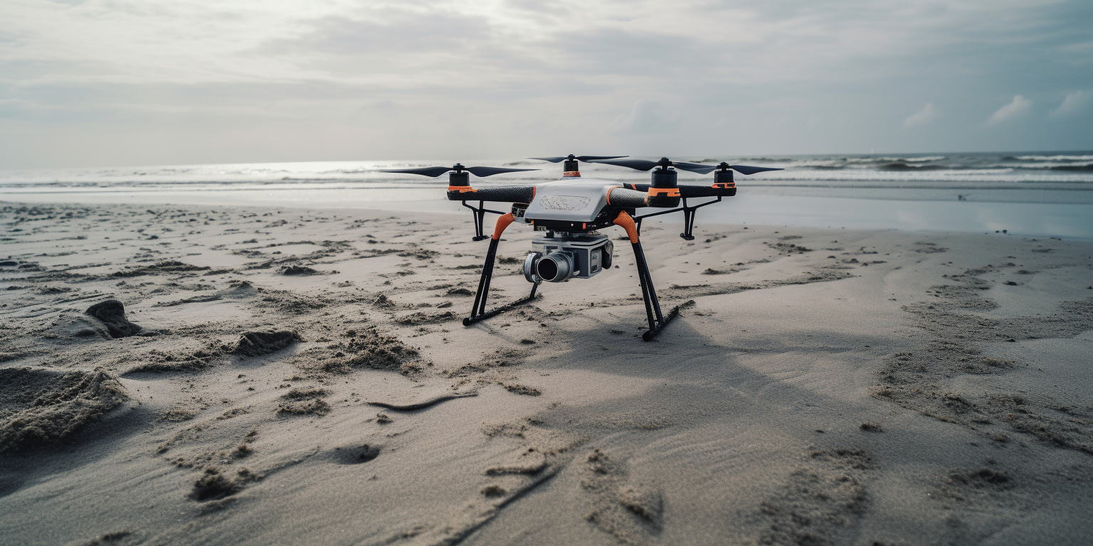
LiDAR Applications in Drones
With the rapid development of drone technology, Drones for LiDAR, LiDAR Drones, and Drones with LiDAR have become integral to modern aerial perception systems. By integrating LiDAR sensors into UAV platforms, LiDAR Scanner Drones are enabling breakthrough applications in several key areas:
1. High-Precision 3D Modeling (LiDAR Mapping Drone)
Combining drones with LiDAR enables rapid and detailed 3D scanning and modeling of environments like urban infrastructure, forests, farmland, and waterworks:
-
Real-time construction of high-precision 3D models of terrain, roads, and buildings;
-
Providing accurate inputs for Geographic Information Systems (GIS);
-
Supporting natural disaster monitoring and early warning, such as landslides and floods.
2. Environmental Sensing and Monitoring
Drones equipped with ToF and LiDAR, alongside multi-modal environmental sensors (temperature, humidity, air pressure, PM2.5, etc.), can collect critical data in real time:
-
Air quality and pollution indices;
-
Agricultural microclimate monitoring;
-
Industrial emission tracking;
-
Forest fire detection and heat warning.
This integrated platform greatly enhances the spatial coverage and responsiveness of environmental perception, making it ideal for smart city infrastructure, sustainable agriculture, and disaster response systems.
3. Flight Vision and Path Planning
By integrating forward-facing cameras and laser scanners, drone systems can merge visual and radar data to:
-
Achieve accurate SLAM-based autonomous navigation and dynamic flight path adjustment;
-
Detect obstacles such as power lines, buildings, and trees in real time;
-
Analyze terrain changes through depth maps and ToF-based distance data, optimizing energy consumption and flight stability.
This visual-radar fusion approach significantly boosts drone intelligence, enabling missions in complex environments like navigating between urban skyscrapers or patrolling dense forests.
ToF + LiDAR = The New Power Behind Autonomous Driving and Smart Sensing
As smart transportation and autonomous driving advance, ToF technology, at the core of LiDAR ranging systems, is becoming the engine behind next-generation smart vehicles and robotic perception systems.
In the LiDAR Automotive sector, onboard LiDAR sensors powered by ToF technology emit laser pulses and capture reflected signals to rapidly acquire 3D spatial data of the vehicle’s surroundings. Combined with multi-sensor fusion algorithms (with cameras, radar, GPS, etc.), this enables:
Key Capabilities in Autonomous Driving:
-
360° Environmental Mapping: Real-time 3D point clouds for detecting roads, vehicles, pedestrians, and obstacles;
-
Smart Path Planning: Depth data matched against high-definition maps to determine optimal driving routes;
-
Dynamic Obstacle Avoidance: Immediate response to sudden obstacles (e.g., jaywalking pedestrians or sudden braking);
-
Robust Operation in Adverse Conditions: Unlike traditional vision systems, ToF LiDAR works reliably in darkness, rain, and fog.
Three Core Advantages of ToF Technology:
1. Rapid Response
Based on ToF principles, each laser pulse takes only nanoseconds to microseconds to measure distance, enabling the entire system to refresh 3D imagery at tens or hundreds of hertz for millisecond-level environmental awareness.
2. High-Precision Measurement
ToF sensors can achieve millimeter-level accuracy, critical for obstacle detection, lane keeping, and parking assistance in autonomous vehicles.
3. All-Weather Operation
Unlike camera-based systems, ToF + LiDAR do not rely on ambient lighting, ensuring stable sensing in darkness, bright light, rain, snow, and fog, significantly improving reliability and robustness.

Future Trend: ToF Meets AI
With advancements in AI chips and edge computing, ToF and LiDAR will evolve from passive sensing systems to intelligent perception engines deeply integrated with neural networks. This enables predictive analytics, scene understanding, and behavior modeling in applications like autonomous vehicles, delivery robots, and security systems.
The Future of ToF in Drones and Environmental Perception
With the rapid development of ToF (Time-of-Flight) and LiDAR technologies, the future of LiDAR drones and environmental sensing systems is moving toward greater intelligence, efficiency, and accuracy, empowering sectors like smart cities, agriculture, public safety, and ecology.
1. Miniaturization and High Integration
Future ToF sensors will become lighter, smaller, and more energy-efficient, making them suitable for integration into various types of lightweight UAVs (multirotor, fixed-wing, hybrid). With SoC (System-on-Chip) integration, ToF modules will combine flight control, inertial navigation, and wireless communication into seamless plug-and-play systems.
-
Agricultural drones using ToF + LiDAR can control spray height and routes precisely, reducing waste.
-
Miniature environmental monitoring drones will be able to navigate complex terrains like forests, caves, or disaster zones to conduct real-time 3D scanning and data collection.
2. AI-Powered Intelligent Perception
ToF will evolve from a simple distance sensor to a key input for environmental understanding, deeply integrated with AI technologies:
-
Dynamic target tracking and recognition (e.g., wildlife, pedestrians, vehicles);
-
Behavior prediction and path planning: AI-powered drones can foresee target movements and obstacles, adjusting routes autonomously;
-
Integration with neural networks will lead to perception systems that understand their surroundings, enabling better decision-making in complex environments.
3. Multi-Sensor Fusion Systems
ToF + LiDAR will form part of a multimodal sensing ecosystem, enhancing perception range and capability:
-
Camera + ToF: For target recognition and 3D modeling;
-
Thermal Imaging + ToF: Detects living beings and fire sources in low-visibility conditions;
-
Air quality/weather sensors + ToF: Collect real-time PM2.5, temperature, humidity, wind speed at varying altitudes, creating an 'aerial weather station.'
4. Extended Ranging and Terrain Adaptability
By combining high-power laser emitters and highly sensitive detectors, next-gen ToF systems will overcome current distance limits, enabling sensing up to tens or even hundreds of meters, perfect for:
-
3D mapping in plateaus, mountainous, and forest regions;
-
Monitoring structural safety of large buildings;
-
Rapid scanning in post-disaster scenarios to locate survivors in collapsed areas.
Conclusion: ToF Will Define the Future of Spatial Intelligence
From distance measurement to spatial understanding, from scanning to intelligent perception, ToF technology is becoming the key enabler for machines to interpret the world. As drone systems grow smarter, the combination of ToF and LiDAR will form the foundation of future spatial intelligence systems, advancing the evolution from 'seeing' to 'understanding.'
Final Words: ToF Powers the New Era of Smart Flight
From LiDAR-equipped drones to environmental monitoring and autonomous driving, ToF technology is expanding its applications across the board. It is not only the cornerstone of future drone perception systems but also a vital technology for smart cities, intelligent agriculture, and clean energy monitoring.
As ToF technology continues to integrate with LiDAR drones, environmental sensors, and automotive LiDAR, it will empower a world where aerial perception is more precise, intelligent, and efficient than ever before.
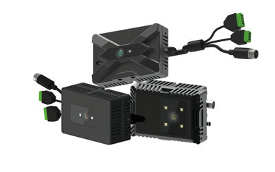
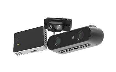
Synexens Industrial Outdoor 4m TOF Sensor Depth 3D Camera Rangefinder_CS40p

After-sales Support:
Our professional technical team specializing in 3D camera ranging is ready to assist you at any time. Whether you encounter any issues with your TOF camera after purchase or need clarification on TOF technology, feel free to contact us anytime. We are committed to providing high-quality technical after-sales service and user experience, ensuring your peace of mind in both shopping and using our products.
:%20Powering%20LiDAR%20Drones%20%26%20Environmental%20Perception)